Area Overview for BN1 9GD
Photos of BN1 9GD
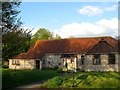
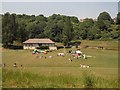
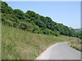
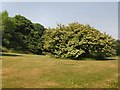
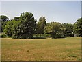
33 photos from this area
Area Information
Key information about the BN1 9GD including its size, population, and administrative classification.
- Area Type
- Postcode
- Area Size
- 1.8 hectares
- Population
- 4165
- Population Density
- 1271 people/km²
House Prices in BN1 9GD
38
Properties
£293,307
Average Sold Price
£84,950
Lowest Price
£550,000
Highest Price
Showing 38 properties
| Address | Type | Beds | Baths | Last Sale Price | Last Sale Date | |
|---|---|---|---|---|---|---|
| 32 Coldean Lane, Brighton, BN1 9GD | Semi-detached | 3 | 1 | £350,000 | Jul 2025 | |
| 8 Coldean Lane, Brighton, BN1 9GD | house | - | - | £450,000 | Jul 2024 | |
| 21 Coldean Lane, Brighton, BN1 9GD | Detached | 3 | 1 | £395,200 | Nov 2023 | |
| 19 Coldean Lane, Brighton, BN1 9GD | Detached | 3 | 1 | £405,000 | Jul 2023 | |
| 28 Coldean Lane, Brighton, BN1 9GD | house | - | - | £510,000 | Mar 2023 | |
| 11 Coldean Lane, Brighton, BN1 9GD | house | 4 | 2 | £550,000 | Jan 2023 | |
| 6 Coldean Lane, Brighton, BN1 9GD | Detached | 7 | 2 | £430,000 | Feb 2022 | |
| 23 Coldean Lane, Brighton, BN1 9GD | house | - | - | £385,000 | Feb 2021 | |
| 5 Coldean Lane, Brighton, BN1 9GD | Detached | 1 | 1 | £376,500 | Oct 2020 | |
| 27 Coldean Lane, Brighton, BN1 9GD | Detached | 6 | 2 | £500,000 | Feb 2020 |
Page 1 of 4
Energy Efficiency in BN1 9GD
Amenities
Schools
| Rank | School | Type | Entry gender | Ages |
|---|
Explore more schools in this area
Go to Schools tabDemographics
Household Size
Family (3-5 people)
most common
Accommodation Type
Houses
most common
Tenure
53
majority
Ethnic Group
White
most common
Religion
N/A
most common
Household Composition
N/A
most common
Age
22
median
Young Adults (15-29 years)
most common
Household Deprivation
N/A
with no deprivation
NS-SEC
6
in Lower managerial occupations
Explore more demographic insights in this area
Go to Demographics tabPlanning
Planning Constraints
- Flood RiskPremium
- Ramsar Wetland SitesPremium
- Area of Outstanding Natural BeautyPremium
- Protected Nature ReservePremium
- Protected WoodlandPremium