Area Overview for BN1 8FP
Photos of BN1 8FP
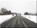
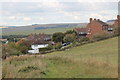
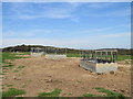
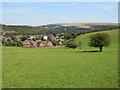
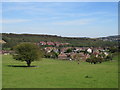
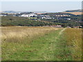
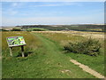
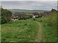
48 photos from this area
Area Information
Key information about the BN1 8FP including its size, population, and administrative classification.
- Area Type
- Postcode
- Area Size
- 2.3 hectares
- Population
- Not available
- Population Density
- Not available
House Prices in BN1 8FP
38
Properties
£289,167
Average Sold Price
£52,500
Lowest Price
£477,000
Highest Price
Showing 38 properties
| Address | Type | Beds | Baths | Last Sale Price | Last Sale Date | |
|---|---|---|---|---|---|---|
| 62 Rotherfield Crescent, Brighton, BN1 8FP | Semi-detached | 3 | 1 | £477,000 | Nov 2024 | |
| 100 Rotherfield Crescent, Brighton, BN1 8FP | Retail | 3 | - | £450,000 | Mar 2022 | |
| 68 Rotherfield Crescent, Brighton, BN1 8FP | house | - | - | £455,000 | Sep 2021 | |
| 112 Rotherfield Crescent, Brighton, BN1 8FP | house | - | - | £450,000 | Jun 2021 | |
| 102 Rotherfield Crescent, Brighton, BN1 8FP | house | - | - | £375,000 | Jan 2020 | |
| 94 Rotherfield Crescent, Brighton, BN1 8FP | house | - | - | £380,000 | Sep 2019 | |
| 98 Rotherfield Crescent, Brighton, BN1 8FP | house | - | - | £380,000 | Sep 2019 | |
| 106 Rotherfield Crescent, Brighton, BN1 8FP | house | - | - | £390,000 | Jun 2018 | |
| 60 Rotherfield Crescent, Brighton, BN1 8FP | Semi-detached | 3 | 1 | £370,000 | Mar 2018 | |
| 108 Rotherfield Crescent, Brighton, BN1 8FP | house | - | - | £68,990 | Oct 2016 |
Page 1 of 4
Energy Efficiency in BN1 8FP
Amenities
Schools
| Rank | School | Type | Entry gender | Ages |
|---|
Explore more schools in this area
Go to Schools tabDemographics
Household Size
Family (3-5 people)
most common
Accommodation Type
Houses
most common
Tenure
57
majority
Ethnic Group
White
most common
Religion
N/A
most common
Household Composition
N/A
most common
Age
47
median
Adults (30-64 years)
most common
Household Deprivation
N/A
with no deprivation
NS-SEC
29
in Lower managerial occupations
Explore more demographic insights in this area
Go to Demographics tabPlanning
Planning Constraints
- Flood RiskPremium
- Ramsar Wetland SitesPremium
- Area of Outstanding Natural BeautyPremium
- Protected Nature ReservePremium
- Protected WoodlandPremium