Area Overview for BN1 8AS
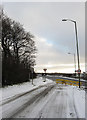
Photos of BN1 8AS
Area Information
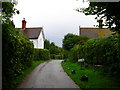
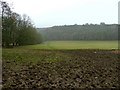
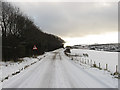
BN1 8AS lies within the Patcham & Hollingbury Ward, a small residential cluster in Brighton & Hove, just 3 miles north of the city centre. With a population of 1,585 spread across 4.6 hectares, it is one of the most densely populated areas in England, at 34,117 people per square kilometre. Historically part of the former Patcham parish, the area retains echoes of its 13th-century roots, including All Saints’ Church and the 1928 boundary markers known as the “Pylons.” Despite its compact size, it offers a mix of suburban tranquillity and proximity to Brighton’s amenities. Residents benefit from nearby rail links to the city and access to retail hubs like Asda and Sainsburys. The area’s character is defined by its mix of older housing stock and post-war developments, with a focus on family homes. While its high density may feel intimate, the presence of green spaces and historical sites adds depth to daily life. For buyers, BN1 8AS represents a unique blend of compact living and historical significance, though its small footprint means limited expansion potential.
- Area Type
- Postcode
- Area Size
- 4.6 hectares
- Population
- Not available
- Population Density
- Not available
BN1 8AS is predominantly an owner-occupied area, with 57% of homes owned by residents rather than rented. The accommodation type is largely houses, which is unusual for a high-density postcode, suggesting a mix of older, detached properties and post-war semi-detached housing. Given the area’s small size and high population density, the housing stock is limited, making it a competitive market for buyers. The focus on owner-occupation implies that many residents are long-term residents, potentially driving up property values. However, the lack of flats or apartments may limit options for those seeking smaller or more affordable units. Buyers should consider the area’s proximity to Brighton’s city centre, which could enhance property value, but also note the constraints of its compact footprint. The surrounding areas may offer more variety, but BN1 8AS itself is best suited for those prioritising established, family-friendly homes over investment potential.
House Prices in BN1 8AS
Showing 2 properties
| Address | Type | Beds | Baths | Last Sale Price | Last Sale Date | |
|---|---|---|---|---|---|---|
| Mcdonald's At Asda, Restaurant Unit, 1 Crowhurst Road, Brighton, BN1 8AS | Retail | - | - | - | - | |
| Asda Pharmacy, Pharmacy, 1 Crowhurst Road, Brighton, BN1 8AS | shop | - | - | - | - |
Energy Efficiency in BN1 8AS
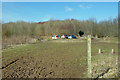
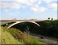
Living in BN1 8AS offers access to a range of retail and transport hubs within walking distance. The area’s proximity to Asda Brighton, M&S Carden Av Brighton, and Sainsburys Brighton ensures daily shopping needs are met. Three major rail stations—Moulsecoomb, Falmer, and Preston Park—provide easy access to Brighton’s city centre and beyond, supporting both commuting and leisure travel. The area’s historical character is complemented by nearby green spaces, such as the All Saints’ Church conservation area and the former Patcham Place, a Grade-listed site with historical significance. While the immediate area is residential, its connection to Brighton means residents can access the city’s cultural and recreational offerings. The compact nature of BN1 8AS means amenities are concentrated, requiring minimal travel for essentials, though larger retail or entertainment options would necessitate a trip to Brighton. The blend of practicality and historical interest defines the lifestyle here.
Amenities
Schools
| Rank | School | Type | Entry gender | Ages |
|---|
Explore more schools in this area
Go to Schools tabDemographics
BN1 8AS has a median age of 47, with the majority of residents aged 30–64. This suggests a community skewed towards middle-aged adults, likely including professionals and families. Home ownership stands at 57%, slightly below the national average, with houses being the predominant accommodation type. The population is predominantly White, reflecting broader demographic trends in Brighton & Hove. The high population density—34,117 per square kilometre—means living spaces are closely packed, which can influence community dynamics and the availability of private outdoor space. While no specific deprivation data is provided, the age profile and ownership rates indicate a stable, established population. The lack of younger residents may affect local schools and amenities, though the area’s proximity to Brighton offers broader access to services. This demographic profile suggests a mature, settled community with a focus on long-term residency rather than transient populations.
Household Size
Accommodation Type
Tenure
Ethnic Group
Religion
Household Composition
Age
Household Deprivation
NS-SEC
Explore more demographic insights in this area
Go to Demographics tabPlanning
Planning Constraints
- Flood RiskPremium
- Ramsar Wetland SitesPremium
- Area of Outstanding Natural BeautyPremium
- Protected Nature ReservePremium
- Protected WoodlandPremium