Area Overview for BN1 6UX
Photos of BN1 6UX
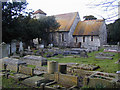
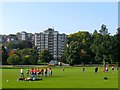
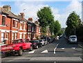
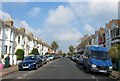


100 photos from this area
Area Information
Key information about the BN1 6UX including its size, population, and administrative classification.
- Area Type
- Postcode
- Area Size
- 2633 m²
- Population
- Not available
- Population Density
- Not available
House Prices in BN1 6UX
40
Properties
£202,055
Average Sold Price
£50,000
Lowest Price
£307,500
Highest Price
Showing 40 properties
| Address | Type | Beds | Baths | Last Sale Price | Last Sale Date | |
|---|---|---|---|---|---|---|
| 79, Kingsmere, London Road, Preston, Brighton, BN1 6UX | Flat | - | - | £290,000 | Mar 2025 | |
| 69, Kingsmere, London Road, Preston, Brighton, BN1 6UX | Flat | - | - | £307,500 | Jan 2024 | |
| 77, Kingsmere, London Road, Preston, Brighton, BN1 6UX | Flat | - | - | £300,000 | Nov 2023 | |
| 63, Kingsmere, London Road, Preston, Brighton, BN1 6UX | Flat | 1 | 1 | £220,000 | May 2023 | |
| 51, Kingsmere, London Road, Preston, Brighton, BN1 6UX | Flat | - | - | £300,000 | Oct 2022 | |
| 55, Kingsmere, London Road, Preston, Brighton, BN1 6UX | Flat | 2 | 1 | £282,000 | Apr 2022 | |
| 73, Kingsmere, London Road, Preston, Brighton, BN1 6UX | Flat | - | - | £210,000 | Dec 2021 | |
| 44, Kingsmere, London Road, Preston, Brighton, BN1 6UX | Flat | - | - | £257,000 | Jun 2021 | |
| 57, Kingsmere, London Road, Preston, Brighton, BN1 6UX | Flat | - | - | £289,950 | May 2018 | |
| 66, Kingsmere, London Road, Preston, Brighton, BN1 6UX | Flat | - | - | £285,000 | Jul 2017 |
Page 1 of 4
Energy Efficiency in BN1 6UX
Amenities
Schools
| Rank | School | Type | Entry gender | Ages |
|---|
Explore more schools in this area
Go to Schools tabDemographics
Household Size
Two person
most common
Accommodation Type
Flats
most common
Tenure
65
majority
Ethnic Group
White
most common
Religion
N/A
most common
Household Composition
N/A
most common
Age
47
median
Adults (30-64 years)
most common
Household Deprivation
N/A
with no deprivation
NS-SEC
49
in Lower managerial occupations
Explore more demographic insights in this area
Go to Demographics tabPlanning
Planning Constraints
- Flood RiskPremium
- Ramsar Wetland SitesPremium
- Area of Outstanding Natural BeautyPremium
- Protected Nature ReservePremium
- Protected WoodlandPremium