Area Overview for BN1 6LA
Photos of BN1 6LA
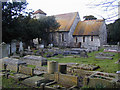
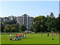
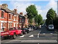
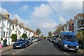
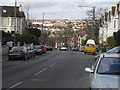

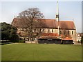
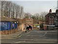
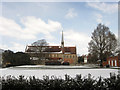


100 photos from this area
Area Information
Key information about the BN1 6LA including its size, population, and administrative classification.
- Area Type
- Postcode
- Area Size
- 20.0 hectares
- Population
- 1607
- Population Density
- 3371 people/km²
House Prices in BN1 6LA
60
Properties
£614,864
Average Sold Price
£212,000
Lowest Price
£1,090,000
Highest Price
Showing 60 properties
| Address | Type | Beds | Baths | Last Sale Price | Last Sale Date | |
|---|---|---|---|---|---|---|
| 59A Preston Drove, Brighton, BN1 6LA | Flat | - | - | £332,000 | Jun 2023 | |
| 19 Preston Drove, Brighton, BN1 6LA | Detached | 5 | 2 | £1,090,000 | Sep 2020 | |
| 47 Preston Drove, Brighton, BN1 6LA | house | 5 | 1 | £780,000 | May 2020 | |
| 49 Preston Drove, Brighton, BN1 6LA | Terraced | 5 | 2 | £860,000 | Mar 2019 | |
| 27 Preston Drove, Brighton, BN1 6LA | house | - | - | £837,500 | Sep 2018 | |
| 21 Preston Drove, Brighton, BN1 6LA | house | - | - | £950,000 | Oct 2016 | |
| 23 Preston Drove, Brighton, BN1 6LA | house | 4 | - | £890,000 | Sep 2015 | |
| 65 Preston Drove, Brighton, BN1 6LA | Terraced | 6 | - | £212,000 | Jan 2015 | |
| 43 Preston Drove, Brighton, BN1 6LA | Terraced | 4 | 2 | £865,000 | Oct 2014 | |
| 25 Preston Drove, Brighton, BN1 6LA | Detached | 4 | - | £740,000 | Aug 2013 |
Page 1 of 6
Energy Efficiency in BN1 6LA
Amenities
Schools
| Rank | School | Type | Entry gender | Ages |
|---|
Explore more schools in this area
Go to Schools tabDemographics
Household Size
One person
most common
Accommodation Type
Flats
most common
Tenure
53
majority
Ethnic Group
White
most common
Religion
N/A
most common
Household Composition
N/A
most common
Age
47
median
Adults (30-64 years)
most common
Household Deprivation
N/A
with no deprivation
NS-SEC
50
in Lower managerial occupations
Explore more demographic insights in this area
Go to Demographics tabPlanning
Planning Constraints
- Flood RiskPremium
- Ramsar Wetland SitesPremium
- Area of Outstanding Natural BeautyPremium
- Protected Nature ReservePremium
- Protected WoodlandPremium