Area Overview for BN1 6DJ
Photos of BN1 6DJ
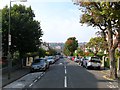
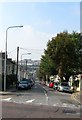
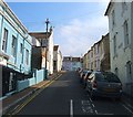
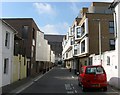
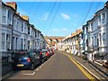
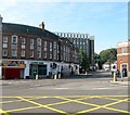
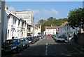
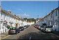
100 photos from this area
Area Information
Key information about the BN1 6DJ including its size, population, and administrative classification.
- Area Type
- Postcode
- Area Size
- 2.1 hectares
- Population
- Not available
- Population Density
- Not available
House Prices in BN1 6DJ
100
Properties
£608,934
Average Sold Price
£30,000
Lowest Price
£1,750,000
Highest Price
Showing 100 properties
| Address | Type | Beds | Baths | Last Sale Price | Last Sale Date | |
|---|---|---|---|---|---|---|
| 42 Florence Road, Brighton, BN1 6DJ | Semi-detached | 4 | 4 | £1,550,000 | Dec 2023 | |
| 6A Florence Road, Brighton, BN1 6DJ | Flat | 2 | 1 | £365,000 | Oct 2023 | |
| 74 Florence Road, Brighton, BN1 6DJ | Semi-detached | 5 | 2 | £970,000 | Nov 2022 | |
| 72 Florence Road, Brighton, BN1 6DJ | Terraced | 4 | 2 | £872,500 | Aug 2018 | |
| 6C Florence Road, Brighton, BN1 6DJ | Flat | - | - | £325,500 | Jan 2017 | |
| 66 Florence Road, Brighton, BN1 6DJ | Semi-detached | 4 | 2 | £865,000 | Nov 2016 | |
| Flat 4, 22 Florence Road, Brighton, BN1 6DJ | Flat | - | - | £30,000 | Sep 2016 | |
| 4A Florence Road, Brighton, BN1 6DJ | Flat | - | - | £375,000 | Sep 2014 | |
| 48A Florence Road, Brighton, BN1 6DJ | Flat | - | - | £1,100,000 | Aug 2014 | |
| 44 Florence Road, Brighton, BN1 6DJ | Detached | 6 | - | £1,750,000 | Jan 2014 |
Page 1 of 10
Energy Efficiency in BN1 6DJ
Amenities
Schools
| Rank | School | Type | Entry gender | Ages |
|---|
Explore more schools in this area
Go to Schools tabDemographics
Household Size
Family (3-5 people)
most common
Accommodation Type
Houses
most common
Tenure
66
majority
Ethnic Group
White
most common
Religion
N/A
most common
Household Composition
N/A
most common
Age
47
median
Adults (30-64 years)
most common
Household Deprivation
N/A
with no deprivation
NS-SEC
53
in Lower managerial occupations
Explore more demographic insights in this area
Go to Demographics tabPlanning
Planning Constraints
- Flood RiskPremium
- Ramsar Wetland SitesPremium
- Area of Outstanding Natural BeautyPremium
- Protected Nature ReservePremium
- Protected WoodlandPremium