Area Overview for BN1 5PR
Photos of BN1 5PR
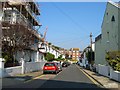
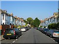
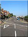
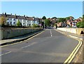
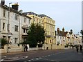
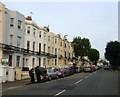
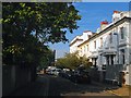
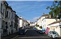
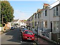
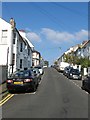
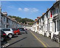
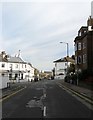
100 photos from this area
Area Information
Key information about the BN1 5PR including its size, population, and administrative classification.
- Area Type
- Postcode
- Area Size
- 2.8 hectares
- Population
- 1810
- Population Density
- 7949 people/km²
House Prices in BN1 5PR
39
Properties
£367,788
Average Sold Price
£76,500
Lowest Price
£667,000
Highest Price
Showing 39 properties
| Address | Type | Beds | Baths | Last Sale Price | Last Sale Date | |
|---|---|---|---|---|---|---|
| 87 Stanford Road, Brighton, BN1 5PR | house | - | - | £520,000 | Nov 2024 | |
| 67 Stanford Road, Brighton, BN1 5PR | Terraced | 4 | 2 | £650,000 | Dec 2020 | |
| 69 Stanford Road, Brighton, BN1 5PR | house | - | - | £667,000 | Jul 2017 | |
| 50 Stanford Road, Brighton, BN1 5PR | house | - | - | £510,000 | Sep 2016 | |
| 81 Stanford Road, Brighton, BN1 5PR | house | - | - | £595,000 | Feb 2015 | |
| 89 Stanford Road, Brighton, BN1 5PR | house | 3 | - | £487,500 | Nov 2013 | |
| 73 Stanford Road, Brighton, BN1 5PR | house | 5 | - | £500,000 | Feb 2012 | |
| 59 Stanford Road, Brighton, BN1 5PR | Detached | - | - | £369,000 | Jul 2008 | |
| 95 Stanford Road, Brighton, BN1 5PR | Detached | - | - | £499,950 | Sep 2006 | |
| 54 Stanford Road, Brighton, BN1 5PR | Detached | - | - | £285,000 | Jan 2006 |
Page 1 of 4
Energy Efficiency in BN1 5PR
Amenities
Schools
| Rank | School | Type | Entry gender | Ages |
|---|
Explore more schools in this area
Go to Schools tabDemographics
Household Size
Two person
most common
Accommodation Type
Houses
most common
Tenure
58
majority
Ethnic Group
White
most common
Religion
N/A
most common
Household Composition
N/A
most common
Age
47
median
Adults (30-64 years)
most common
Household Deprivation
N/A
with no deprivation
NS-SEC
51
in Lower managerial occupations
Explore more demographic insights in this area
Go to Demographics tabPlanning
Planning Constraints
- Flood RiskPremium
- Ramsar Wetland SitesPremium
- Area of Outstanding Natural BeautyPremium
- Protected Nature ReservePremium
- Protected WoodlandPremium