Area Overview for BN1 5NA
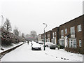
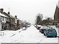
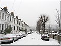
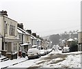
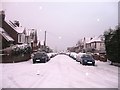
Photos of BN1 5NA


Area Information
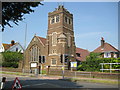
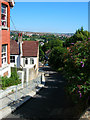
Living in the BN1 5NA postcode area means residing in a dense residential cluster defined by its history and proximity to Preston Park. This small ward covers just 2.5 hectares yet houses 1,707 people, creating a compact community with significant character. The location sits within the Brighton & Hove unitary authority, historically part of the Saxon estate known as Preste-tun and integrated into the city by 1873. You are close to notable landmarks such as Preston Manor, which reopened as a museum in 2025, and the original Preston Park grounds featuring a clock tower from 1892. Daily life here is shaped by the area's connection to the historic London-Brighton railway line and the legacy of the turnpike gates that once challenged traffic on the 1810 route. This specific postcode represents a blend of Victorian development and ancient heritage, offering a lived environment where local history shapes the current neighbourhood atmosphere.
- Area Type
- Postcode
- Area Size
- 2.5 hectares
- Population
- 1707
- Population Density
- 11962 people/km²
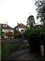
Homes in BN1 5NA are characterised by a predominantly owner-occupied stock, with 67 per cent of residents purchasing their properties outright. The area consists mainly of houses, which aligns with the established nature of this historic ward. This market structure suggests a low level of short-term lettings compared to tourist-heavy zones across Brighton & Hove. Buyers looking at this postcode can expect a residential environment built for families and long-term dwellers rather than commuters seeking weekly rentals. The small geographic footprint of 2.5 hectares limits the scale of new developments, meaning the character of the housing stock remains rooted in its historic evolution from the Saxon era through to the Victorian era. The high ownership figure stabilises the local economy and reduces rental pressure, ensuring that most households have invested directly in their living space.
House Prices in BN1 5NA
Showing 46 properties
| Address | Type | Beds | Baths | Last Sale Price | Last Sale Date | |
|---|---|---|---|---|---|---|
| 105 Tivoli Crescent North, Brighton, BN1 5NA | Detached | 5 | 3 | £1,315,000 | Dec 2024 | |
| 168 Tivoli Crescent North, Brighton, BN1 5NA | Semi-detached | 5 | 2 | £1,150,000 | Jan 2024 | |
| 182 Tivoli Crescent North, Brighton, BN1 5NA | house | 4 | 3 | £1,300,000 | Oct 2022 | |
| 184 Tivoli Crescent North, Brighton, BN1 5NA | Retail | 4 | 2 | £1,143,000 | May 2022 | |
| 172 Tivoli Crescent North, Brighton, BN1 5NA | Detached | 6 | 3 | £1,200,000 | Sep 2021 | |
| 158 Tivoli Crescent North, Brighton, BN1 5NA | Detached | 4 | 3 | £1,160,000 | Jun 2021 | |
| 97 Tivoli Crescent North, Brighton, BN1 5NA | Detached | 4 | - | £1,152,000 | Jun 2021 | |
| 95 Tivoli Crescent North, Brighton, BN1 5NA | Detached | 4 | 2 | £682,600 | Oct 2020 | |
| 99 Tivoli Crescent North, Brighton, BN1 5NA | house | - | - | £750,000 | Sep 2015 | |
| 79 Tivoli Crescent North, Brighton, BN1 5NA | Detached | 5 | - | £1,000,000 | May 2015 |
Energy Efficiency in BN1 5NA
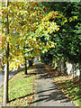
Residents of BN1 5NA enjoy access to a curated selection of amenities within practical reach, ensuring daily convenience without needing to travel far. Nearby retail options include Sainsburys Brighton, Tesco Hove, and Tesco Hove Dyke, allowing for straight-to-the-shop grocery runs. For rail commuters, you are within reach of five key stations, including Preston Park Railway Station, Hove Railway Station, and London Road Railway Station. Travel enthusiasts also benefit from proximity to two airfields: Shoreham Brighton City Airport and Shoreham Airport. The area surrounds significant green spaces, with Preston Park offering walking routes around the historic clock tower and Tile House. This mix of accessible shopping, multiple transport hubs, and historic parks creates a balanced lifestyle where work, leisure, and daily necessities are all easily within commuting distance or walking range.
Amenities
Schools
| Rank | School | Type | Entry gender | Ages |
|---|
Explore more schools in this area
Go to Schools tabDemographics
The community in BN1 5NA reflects a mature population with a median age of 47 years. Most residents fall into the broad adult bracket spanning ages 30 to 64, suggesting a stable demographic of working professionals and retirees. You will find that the area is predominantly occupied by white families, with home ownership standing at a strong 67 per cent. This high ownership rate indicates a neighbourhood where many families have built long-term roots rather than viewing the property as a temporary investment. The accommodation stock consists primarily of houses, supporting a traditional residential pattern rather than high-density blocks of flats. This housing profile creates a quiet, settled environment suitable for those seeking stability. The population density measures roughly 69,662 people per square kilometre, reflecting the compact nature of this specific postcode stretch within the wider Preston Park Ward.
Household Size
Accommodation Type
Tenure
Ethnic Group
Religion
Household Composition
Age
Household Deprivation
NS-SEC
Explore more demographic insights in this area
Go to Demographics tabPlanning
Planning Constraints
- Flood RiskPremium
- Ramsar Wetland SitesPremium
- Area of Outstanding Natural BeautyPremium
- Protected Nature ReservePremium
- Protected WoodlandPremium