Area Overview for BN1 5HZ
Photos of BN1 5HZ


Area Information
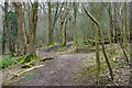
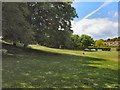
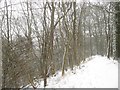
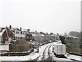
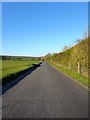
Living in BN1 5HZ means being part of a compact, residential cluster in the heart of Brighton and Hove. With a population of 1,491 and a density of 291 people per square kilometre, this area blends suburban tranquillity with proximity to urban amenities. Situated in the Westdene and Hove Park ward, it lies north of Hove and west of central Brighton, a location shaped by 1920s and 1930s development on former farmland. The area’s character is defined by its mix of older housing stock and well-maintained green spaces, including Hove Park, a historic public park with tennis courts, bowling greens, and historical landmarks. Residents benefit from easy access to nearby retail, transport, and cultural hubs, making it a practical choice for those seeking a balance between community life and city connectivity. The ward’s population of around 11,000 (as of 2021) contrasts with the smaller BN1 5HZ postcode, which reflects a focused, tight-knit neighbourhood. This is an area where daily life revolves around local amenities, family-friendly spaces, and a low crime environment, appealing to those prioritising safety and convenience.
- Area Type
- Postcode
- Area Size
- Not available
- Population
- 1491
- Population Density
- 291 people/km²
The property market in BN1 5HZ is dominated by owner-occupied homes, with 89% of residents living in properties they own. This high rate of home ownership suggests a community of long-term residents rather than a transient rental market. The accommodation type is primarily houses, indicating a suburban character with larger properties compared to flats or apartments. Given the small size of the postcode area, the housing stock is limited, making it a niche market for buyers seeking specific properties. The focus on houses rather than rental units implies lower competition for buyers, though the small area may restrict options. For those considering the wider Westdene and Hove Park ward, the mix of older housing and proximity to amenities like Hove Park could appeal to buyers prioritising family-friendly living. The market’s stability is reinforced by the area’s low crime risk and practical transport links, which enhance its desirability.
House Prices in BN1 5HZ
No properties found in this postcode.
Energy Efficiency in BN1 5HZ
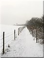
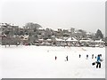
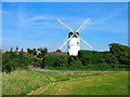
Residents of BN1 5HZ have access to a range of amenities within walking or short driving distance. Nearby retail options include Co-op Patcham, Waitrose Hove, and Tesco Hove, offering everyday shopping needs. The area’s proximity to Hove Park provides recreational space for outdoor activities, with historical features like the Goldstone and original gate piers adding to its charm. The park’s tennis courts, bowling greens, and open spaces cater to families and individuals alike. The presence of multiple railway stations, including Preston Park and Hove, ensures easy access to the city centre and surrounding areas. Airports nearby, such as Shoreham Brighton City Airport, provide additional connectivity. This blend of retail, green space, and transport options creates a convenient, family-friendly environment where daily life is both practical and enjoyable.
Amenities
Schools
The nearest school to BN1 5HZ is Westdene Primary School, which holds an outstanding Ofsted rating. This school serves the local community with primary education, offering a high standard of teaching and facilities. The presence of a well-regarded primary school is a significant draw for families, as it ensures quality early education within walking distance. While no secondary schools are listed in the data, the proximity to Hove Park and the broader Brighton area likely provides access to other educational institutions. The school’s outstanding rating suggests a focus on academic excellence and student welfare, which can be a deciding factor for parents. The single primary school in the immediate vicinity reflects the area’s compact size but also highlights the importance of local education infrastructure in shaping the community’s appeal.
| Rank | School | Type | Entry gender | Ages |
|---|
Explore more schools in this area
Go to Schools tabDemographics
BN1 5HZ has a median age of 47, with the majority of residents aged between 30 and 64. This suggests a mature, established community with strong family ties and a focus on stability. Home ownership is high, at 89%, indicating a predominantly owner-occupied area with long-term residents. The accommodation type is primarily houses, reflecting a suburban layout rather than high-density living. The predominant ethnic group is White, aligning with broader demographic trends in the region. The age profile and home ownership figures suggest a population that values property investment and community continuity. With no data on deprivation or diversity beyond the stated figures, the area appears to cater to middle-aged households seeking a settled, low-maintenance lifestyle. The absence of rental properties implies limited turnover, reinforcing the sense of a stable, long-term resident base.
Household Size
Accommodation Type
Tenure
Ethnic Group
Religion
Household Composition
Age
Household Deprivation
NS-SEC
Explore more demographic insights in this area
Go to Demographics tabPlanning
Planning Constraints
- Flood RiskPremium
- Ramsar Wetland SitesPremium
- Area of Outstanding Natural BeautyPremium
- Protected Nature ReservePremium
- Protected WoodlandPremium