Area Overview for BN1 4PH
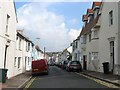
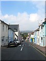
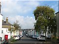
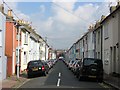
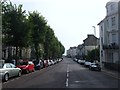
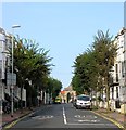
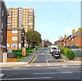
Photos of BN1 4PH

Area Information
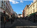
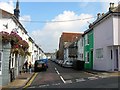
BN1 4PH lies in the heart of Brighton and Hove, a unitary authority in South East England, within the West Hill and North Laine electoral ward. This small postcode area, home to 2,423 residents, sits on the east-facing hill rising from Brighton railway station towards Seven Dials and the historic North Laine district. The area blends urban convenience with a distinct character shaped by its industrial past and bohemian present. Streets like Church Street, Bond Street, and Trafalgar Street reflect its heritage as a former market garden and industrial hub, now lined with boutique shops, cafes, and compact terraces. Proximity to Brighton’s main railway station and major roads like the A259 and A27 ensures easy access to the city’s cultural and economic centres. With a young population skewed towards adults aged 15–29, the area thrives on a dynamic, fast-paced lifestyle, supported by nearby schools, retail, and transport links.
- Area Type
- Postcode
- Area Size
- Not available
- Population
- Not available
- Population Density
- Not available
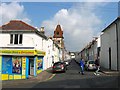
The property market in BN1 4PH is characterised by a high proportion of rental properties, with only 24% of homes owned by residents. The accommodation type is predominantly flats, a reflection of the area’s compact, urban layout. This suggests a limited stock of owner-occupied homes, which may make the area more attractive to renters, particularly students and young professionals seeking short-term housing. The small size of the postcode area means that property availability is constrained, and buyers should consider the immediate surrounding areas for more options. The prevalence of flats also indicates a focus on affordability and space efficiency, though it may limit opportunities for larger family homes. For those seeking ownership, the market is likely competitive, with prices influenced by proximity to amenities and transport links.
House Prices in BN1 4PH
Showing 1 properties
| Address | Type | Beds | Baths | Last Sale Price | Last Sale Date | |
|---|---|---|---|---|---|---|
| Flat 2, 144 London Road, Brighton, BN1 4PH | office_workshop | - | - | - | - |
Energy Efficiency in BN1 4PH
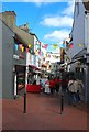
The lifestyle in BN1 4PH is defined by its proximity to retail, dining, and transport hubs. Within practical reach are five notable retail venues, including Aldi Brighton, Co-op Co-o Brighton, and Sainsburys Brighton, ensuring everyday shopping convenience. The area’s rail network, with stations like London Road and Preston Park, facilitates easy travel to Brighton’s cultural and commercial centres. The streets of North Laine, with their boutique shops and cafes, contribute to a vibrant, bohemian atmosphere. Though the area is compact, its mix of retail and transport options supports a dynamic lifestyle, blending urban efficiency with a sense of community. Residents benefit from the convenience of nearby amenities, which complement the area’s historical character and modern practicality.
Amenities
Schools
Residents of BN1 4PH have access to a range of educational institutions, including St Bartholomew’s CofE Primary School, a state-funded primary school, and Bellerbys College Brighton, an independent institution offering higher education. City College Brighton and Hove provides sixth-form education, while Kings Brighton, an independent school, holds a ‘good’ Ofsted rating. This mix of school types caters to diverse needs, from early education to post-16 studies. The presence of both state and independent schools ensures flexibility for families, though the limited number of primary schools may require careful consideration of catchment areas. The proximity to these institutions, combined with the area’s youthful population, suggests a strong focus on education, making it appealing to families seeking a range of academic pathways.
| Rank | School | Type | Entry gender | Ages |
|---|
Explore more schools in this area
Go to Schools tabDemographics
BN1 4PH has a median age of 22, with the majority of residents aged 15–29. This youthful demographic reflects a community shaped by students, young professionals, and those entering the workforce. Home ownership is low at 24%, indicating that most residents rent their homes, which is typical of areas with a high proportion of flats. The accommodation type is predominantly flats, a common feature in urban settings with limited space. The predominant ethnic group is White, though specific data on diversity beyond this is not provided. The young age profile suggests a lively, transient population, which can influence local dynamics, from social activities to housing demand. However, the low home ownership rate also highlights a reliance on rental markets, which may affect long-term stability for some residents.
Household Size
Accommodation Type
Tenure
Ethnic Group
Religion
Household Composition
Age
Household Deprivation
NS-SEC
Explore more demographic insights in this area
Go to Demographics tabPlanning
Planning Constraints
- Flood RiskPremium
- Ramsar Wetland SitesPremium
- Area of Outstanding Natural BeautyPremium
- Protected Nature ReservePremium
- Protected WoodlandPremium