Area Overview for BN1 4NL
Photos of BN1 4NL
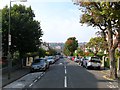
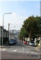
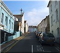
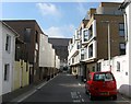
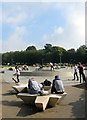
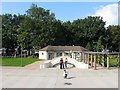
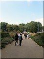
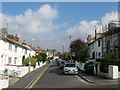
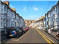
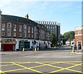
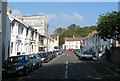
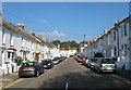
100 photos from this area
Area Information
Key information about the BN1 4NL including its size, population, and administrative classification.
- Area Type
- Postcode
- Area Size
- 3879 m²
- Population
- 1755
- Population Density
- 18750 people/km²
House Prices in BN1 4NL
21
Properties
£381,711
Average Sold Price
£65,000
Lowest Price
£630,000
Highest Price
Showing 21 properties
| Address | Type | Beds | Baths | Last Sale Price | Last Sale Date | |
|---|---|---|---|---|---|---|
| 11 Lorne Road, Brighton, BN1 4NL | Terraced | 2 | 1 | £485,000 | Aug 2023 | |
| 13 Lorne Road, Brighton, BN1 4NL | Terraced | 3 | 2 | £630,000 | Mar 2023 | |
| 1 Lorne Road, Brighton, BN1 4NL | house | 3 | 2 | £567,500 | Dec 2022 | |
| 14 Lorne Road, Brighton, BN1 4NL | house | 3 | 2 | £544,000 | Feb 2021 | |
| 18 Lorne Road, Brighton, BN1 4NL | house | - | - | £427,500 | Sep 2020 | |
| 7 Lorne Road, Brighton, BN1 4NL | Terraced | 3 | 1 | £450,000 | Oct 2019 | |
| 24 Lorne Road, Brighton, BN1 4NL | Terraced | 3 | 2 | £380,000 | Nov 2018 | |
| 4 Lorne Road, Brighton, BN1 4NL | Detached | 3 | 2 | £464,000 | Jun 2018 | |
| 12 Lorne Road, Brighton, BN1 4NL | Terraced | 2 | 1 | £470,000 | Apr 2018 | |
| 9 Lorne Road, Brighton, BN1 4NL | Terraced | 3 | 1 | £510,000 | Dec 2017 |
Page 1 of 3
Energy Efficiency in BN1 4NL
Amenities
Schools
| Rank | School | Type | Entry gender | Ages |
|---|
Explore more schools in this area
Go to Schools tabDemographics
Household Size
Two person
most common
Accommodation Type
Flats
most common
Tenure
53
majority
Ethnic Group
White
most common
Religion
N/A
most common
Household Composition
N/A
most common
Age
47
median
Adults (30-64 years)
most common
Household Deprivation
N/A
with no deprivation
NS-SEC
44
in Lower managerial occupations
Explore more demographic insights in this area
Go to Demographics tabPlanning
Planning Constraints
- Flood RiskPremium
- Ramsar Wetland SitesPremium
- Area of Outstanding Natural BeautyPremium
- Protected Nature ReservePremium
- Protected WoodlandPremium