Area Overview for BN1 4FX
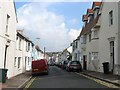
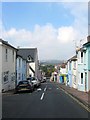
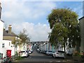
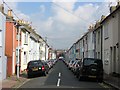
Photos of BN1 4FX

Area Information
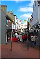
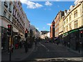
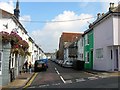
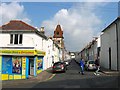
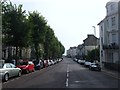
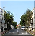
BN1 4FX is a small residential cluster in Brighton and Hove, a coastal city in South East England. With a population of 1,280, it sits within the West Hill and North Laine area, a historically industrial district that has evolved into a mix of compact terraces, boutique shops, and cafes. The area is defined by its proximity to Brighton railway station, with streets like Church Street and Trafalgar Street reflecting its 19th-century development. Residents benefit from easy access to the city’s cultural and commercial hubs, including the vibrant North Laine district, known for its historic conservation area and bohemian character. The postcode’s small size means it is tightly integrated with nearby BN50 and BN2 areas, creating a cohesive local community. Daily life here balances urban convenience with the charm of a historic neighbourhood, though the area’s compact nature means amenities are concentrated within a short walk or cycle. Its location on the A259 and near the A27 motorway also provides connectivity to surrounding regions.
- Area Type
- Postcode
- Area Size
- Not available
- Population
- Not available
- Population Density
- Not available
BN1 4FX is a small area with a housing stock dominated by houses, which is atypical for a city-centre postcode. With 40% of properties owner-occupied, the market appears to cater more to long-term residents than to renters, though the exact proportion of rental properties is not specified. The predominance of houses suggests a focus on family homes or larger properties, which may be in demand for their space and historical character. However, the area’s compact size means the housing stock is limited, and buyers may need to consider nearby BN50 or BN2 areas for more options. The mix of terraced and semi-detached housing reflects the area’s 19th-century development, with properties often benefiting from proximity to Brighton’s amenities. For buyers, the challenge lies in the limited supply, but the area’s historic charm and transport links may offset this.
House Prices in BN1 4FX
No properties found in this postcode.
Energy Efficiency in BN1 4FX
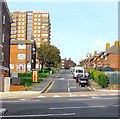
Living in BN1 4FX offers access to a range of retail and transport hubs within walking distance. The area is served by five retail venues, including Budgens Brighton, M&S Brighton Rail SF, and Aldi Brighton, providing everyday shopping convenience. Nearby railway stations—London Road, Preston Park, and Hove—offer frequent services to Brighton’s city centre and beyond, making commuting efficient. The historic North Laine district, just minutes away, adds cultural and leisure options, with its conservation area featuring boutique shops and cafes. While the area’s small size means parks and green spaces are limited, its proximity to Brighton’s larger parks, such as Preston Park, is a plus. The compact nature of BN1 4FX means amenities are concentrated, creating a self-contained but urban lifestyle. Residents benefit from the area’s historic character and easy access to the city’s vibrancy, though the lack of large-scale leisure facilities may require travel for more extensive options.
Amenities
Schools
| Rank | School | Type | Entry gender | Ages |
|---|
Explore more schools in this area
Go to Schools tabDemographics
BN1 4FX has a median age of 47, with the majority of residents aged between 30 and 64 years. This suggests a mature, stable community with a focus on established households. Home ownership accounts for 40% of properties, indicating a mix of owner-occupied and rental homes. The predominant accommodation type is houses, which is unusual for a city-centre postcode but reflects the area’s historical development as a residential quarter. The predominant ethnic group is White, with no specific data on other demographics provided. The age profile and home ownership rate suggest a population that is largely settled, with fewer young families or transient renters compared to other urban areas. The absence of specific data on deprivation or diversity means the area’s social dynamics are not fully quantified, but the figures imply a relatively uniform demographic profile.
Household Size
Accommodation Type
Tenure
Ethnic Group
Religion
Household Composition
Age
Household Deprivation
NS-SEC
Explore more demographic insights in this area
Go to Demographics tabPlanning
Planning Constraints
- Flood RiskPremium
- Ramsar Wetland SitesPremium
- Area of Outstanding Natural BeautyPremium
- Protected Nature ReservePremium
- Protected WoodlandPremium