Area Overview for BN1 3TW
Photos of BN1 3TW
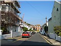
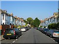
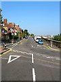
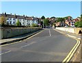
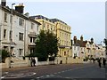
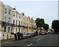
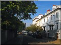
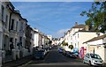
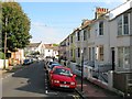
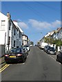
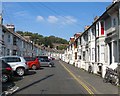
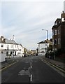
100 photos from this area
Area Information
Key information about the BN1 3TW including its size, population, and administrative classification.
- Area Type
- Postcode
- Area Size
- 1318 m²
- Population
- 1782
- Population Density
- 19497 people/km²
House Prices in BN1 3TW
27
Properties
£192,892
Average Sold Price
£43,250
Lowest Price
£430,000
Highest Price
Showing 27 properties
| Address | Type | Beds | Baths | Last Sale Price | Last Sale Date | |
|---|---|---|---|---|---|---|
| 11, Buckingham Close, Bath Street, Brighton, BN1 3TW | Flat | 2 | 1 | £215,000 | Jun 2025 | |
| 23, Buckingham Close, Bath Street, Brighton, BN1 3TW | Flat | 2 | 1 | £430,000 | Mar 2025 | |
| 4, Buckingham Close, Bath Street, Brighton, BN1 3TW | Flat | - | - | £345,000 | May 2024 | |
| 22, Buckingham Close, Bath Street, Brighton, BN1 3TW | Flat | 2 | 1 | £277,000 | Aug 2022 | |
| 3, Buckingham Close, Bath Street, Brighton, BN1 3TW | Flat | 2 | 1 | £315,000 | Mar 2021 | |
| 17, Buckingham Close, Bath Street, Brighton, BN1 3TW | Flat | - | - | £290,000 | Nov 2020 | |
| 2, Buckingham Close, Bath Street, Brighton, BN1 3TW | Flat | - | - | £195,000 | Jan 2018 | |
| 14, Buckingham Close, Bath Street, Brighton, BN1 3TW | Flat | - | - | £269,500 | Nov 2017 | |
| 27, Buckingham Close, Bath Street, Brighton, BN1 3TW | Flat | - | - | £293,000 | May 2017 | |
| 1, Buckingham Close, Bath Street, Brighton, BN1 3TW | Flat | 1 | 1 | £252,000 | Mar 2016 |
Page 1 of 3
Energy Efficiency in BN1 3TW
Amenities
Schools
| Rank | School | Type | Entry gender | Ages |
|---|
Explore more schools in this area
Go to Schools tabDemographics
Household Size
One person
most common
Accommodation Type
Flats
most common
Tenure
34
majority
Ethnic Group
White
most common
Religion
N/A
most common
Household Composition
N/A
most common
Age
47
median
Adults (30-64 years)
most common
Household Deprivation
N/A
with no deprivation
NS-SEC
49
in Lower managerial occupations
Explore more demographic insights in this area
Go to Demographics tabPlanning
Planning Constraints
- Flood RiskPremium
- Ramsar Wetland SitesPremium
- Area of Outstanding Natural BeautyPremium
- Protected Nature ReservePremium
- Protected WoodlandPremium