Area Overview for BN1 2RL
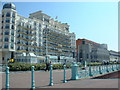
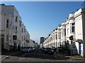
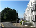
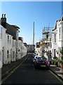
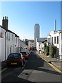
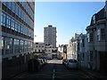
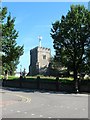
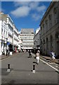
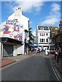
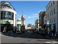
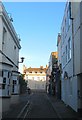
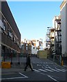
Photos of BN1 2RL
Area Information
BN1 2RL is a small residential postcode in Brighton and Hove, nestled within the historic Regency Ward. This area, spanning 2,312 square metres, is home to 1,783 residents, creating a densely populated yet compact community. Its proximity to Brighton’s seafront and landmarks like the Royal Pavilion defines its character. The ward’s Regency-era architecture, with its white stucco buildings and elegant squares, reflects its 18th-century origins as a hub for high society. Today, it remains a transient district, attracting a mix of professionals and students drawn to its cultural vibrancy and proximity to the city’s amenities. Daily life here is shaped by the area’s compact size and access to transport links, with residents frequently navigating between the seafront, retail hubs, and railway stations. The area’s historical significance, combined with modern connectivity, makes it a unique blend of heritage and practicality for those seeking a dynamic urban lifestyle.
- Area Type
- Postcode
- Area Size
- 2312 m²
- Population
- 1783
- Population Density
- 3976 people/km²
The property market in BN1 2RL is characterised by a low rate of home ownership (19%) and a prevalence of flats. This suggests the area functions more as a rental market than an owner-occupied one, likely due to its small size and transient population. Flats dominate the housing stock, which may reflect the area’s density and historical development as a residential cluster. For buyers, this means limited availability of private homes, with competition likely focused on a small number of properties. The compact nature of BN1 2RL also means that proximity to amenities and transport is a key consideration. Those seeking to purchase may find opportunities limited to specific properties, with the area’s character and location—near the seafront and transport links—offering potential for investment in rental properties.
House Prices in BN1 2RL
Showing 3 properties
| Address | Type | Beds | Baths | Last Sale Price | Last Sale Date | |
|---|---|---|---|---|---|---|
| Sixth Floor, 15-18 West Street, Brighton, BN1 2RL | Office | - | - | - | - | |
| Seventh Floor, 15-18 West Street, Brighton, BN1 2RL | Office | - | - | - | - | |
| Family Assurance Friendly Society, 15-18 West Street, Brighton, BN1 2RL | office_workshop | - | - | - | - |
Energy Efficiency in BN1 2RL
BN1 2RL offers a range of amenities within practical reach, including five retail outlets such as Sainsburys Brighton, Tesco Brighton, and Co-op Brighton. These shops provide everyday essentials, supporting a convenient lifestyle. The area’s proximity to Brighton’s seafront and historical sites like Regency Square adds to its cultural appeal, though the transient nature of the community may mean a less established local social scene. Residents can access rail stations for travel, while the area’s compact size ensures that most amenities are within walking distance. This blend of retail, transport, and historical context creates a functional, if dynamic, environment for daily life.
Amenities
Schools
The nearest school to BN1 2RL is Middle Street Primary School, which serves the area’s younger residents. Rated ‘good’ by Ofsted, it provides a foundation for primary education within walking distance of many homes. However, the data does not list secondary schools or other educational institutions in the immediate vicinity. This means families with older children may need to look further afield for secondary schooling. The presence of a primary school with a positive rating is a benefit for local families, but the lack of nearby secondary options could be a consideration for those prioritising a full range of educational facilities.
| Rank | School | Type | Entry gender | Ages |
|---|
Explore more schools in this area
Go to Schools tabDemographics
BN1 2RL has a median age of 22, with the majority of residents aged 15–29. This young demographic dominates the area, reflecting its transient nature and appeal to students or early-career professionals. Home ownership is low at 19%, indicating that most residents rent their accommodation. The primary housing type is flats, which aligns with the area’s compact size and high population density of 771,128 people per square kilometre. The predominant ethnic group is White, though specific data on diversity beyond this is not provided. The high proportion of young adults suggests a community focused on social and professional mobility, with limited long-term settlement. This profile influences local services and amenities, which cater to a dynamic, short-term population rather than established families.
Household Size
Accommodation Type
Tenure
Ethnic Group
Religion
Household Composition
Age
Household Deprivation
NS-SEC
Explore more demographic insights in this area
Go to Demographics tabPlanning
Planning Constraints
- Flood RiskPremium
- Ramsar Wetland SitesPremium
- Area of Outstanding Natural BeautyPremium
- Protected Nature ReservePremium
- Protected WoodlandPremium