Area Overview for BN1 2GG
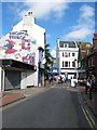
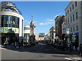
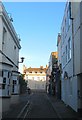
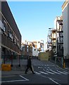
Photos of BN1 2GG
Area Information
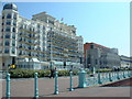
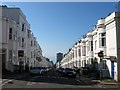
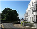
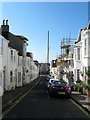
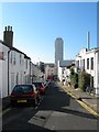
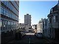
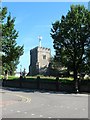
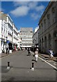
BN1 2GG lies in the heart of Brighton’s central seafront district, a historically significant area shaped by the Regency era. This small postcode covers just 512 m², yet it houses 1,624 residents in a densely packed residential cluster. The area is defined by its Regency-era architecture, with classical white stucco buildings and elegant squares that reflect Brighton’s 18th-century transformation under the Prince Regent. You’re within walking distance of Regency Square, a landmark laid out in 1818, and the Royal Pavilion, a UNESCO-listed palace that remains a cultural cornerstone. The ward’s transient character means it’s popular with professionals and families seeking proximity to the seafront’s amenities. With its mix of historic charm and modern convenience, BN1 2GG offers a unique blend of heritage and urban living, though its compact size means every resident shares space with a tightly woven community.
- Area Type
- Postcode
- Area Size
- 512 m²
- Population
- Not available
- Population Density
- Not available
BN1 2GG’s property market is characterised by a high proportion of rental flats, with only 31% of homes owned outright. This suggests a transient population, typical of urban seafront areas where demand for short-term stays or investment properties outpaces owner-occupation. The small area size and concentration of flats mean the housing stock is limited, with little scope for large family homes. For buyers, this implies competition for available properties, particularly in the private rental sector. The area’s historic architecture and proximity to attractions like the Royal Pavilion may drive interest from investors seeking premium rental yields. However, the small footprint means buyers must consider proximity to nearby areas for additional space or amenities.
House Prices in BN1 2GG
No properties found in this postcode.
Energy Efficiency in BN1 2GG
Living in BN1 2GG offers access to a range of amenities within walking distance. Retail options include Sainsburys Brighton, Waitrose Brighton, and Tesco Brighton, ensuring convenience for daily shopping. The area’s proximity to rail stations like London Road and Hove means public transport is readily available, reducing the need for a car. Shoreham Brighton City Airport is also nearby, adding to the area’s connectivity. The seafront location provides opportunities for leisure, with parks and historic sites like the Royal Pavilion nearby. While the area is compact, its density ensures that essential services are close at hand, supporting a lifestyle that balances urban convenience with coastal charm.
Amenities
Schools
| Rank | School | Type | Entry gender | Ages |
|---|
Explore more schools in this area
Go to Schools tabDemographics
The population of BN1 2GG skews towards adults aged 30–64, with a median age of 47. This suggests a mature, established community, though the area’s transient nature may see shifts in demographics. Home ownership is relatively low at 31%, indicating a rental-dominated market. The predominant accommodation type is flats, reflecting the area’s compact footprint and historic building stock. The majority of residents identify as White, though specific data on diversity is not provided. With a population density of 3.17 million per km², the area is among the most densely populated in England. This density may influence the pace of daily life, with limited private outdoor space but proximity to shared amenities. The low home ownership rate suggests a reliance on rental properties, which could affect long-term stability for residents.
Household Size
Accommodation Type
Tenure
Ethnic Group
Religion
Household Composition
Age
Household Deprivation
NS-SEC
Explore more demographic insights in this area
Go to Demographics tabPlanning
Planning Constraints
- Flood RiskPremium
- Ramsar Wetland SitesPremium
- Area of Outstanding Natural BeautyPremium
- Protected Nature ReservePremium
- Protected WoodlandPremium