Area Overview for BN1 2BL
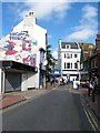
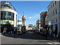
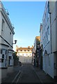
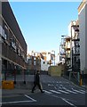
Photos of BN1 2BL
Area Information
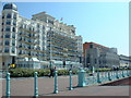
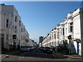
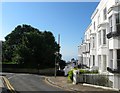
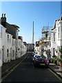
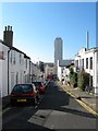
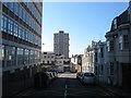
BN1 2BL lies in the heart of Brighton’s Regency-era seafront, a district defined by its historical significance and architectural charm. With a population of 1,783, this small postcode area is part of the Regency Ward, known for its elegant squares, stucco buildings, and proximity to landmarks like the Royal Pavilion. The area’s character stems from its 18th-century development, when the Prince Regent transformed Brighton into a fashionable retreat. Today, it retains a transient feel, attracting young professionals and students drawn to its coastal location and cultural vibrancy. Despite its compact size, the area offers easy access to Brighton’s amenities, from retail hubs to transport links. However, its small footprint means residents often look beyond BN1 2BL for broader opportunities. The mix of historic infrastructure and modern connectivity makes it a unique blend of heritage and practicality, though its transient nature reflects the challenges of living in a high-demand, limited-space environment.
- Area Type
- Postcode
- Area Size
- Not available
- Population
- 1783
- Population Density
- 3976 people/km²
The property market in BN1 2BL is shaped by its small size and high demand. With only 19% of residents owning their homes, the area is predominantly a rental market, dominated by flats. This suggests limited availability of owner-occupied properties, particularly for those seeking larger or more permanent residences. The concentration of flats may reflect the area’s historical development, which prioritised compact, multi-unit housing. For buyers, this means competition is likely to be fierce, especially for properties that are rare in this postcode. The limited housing stock also means that those considering BN1 2BL may need to look beyond its immediate boundaries to find more options. The transient nature of the population, coupled with the area’s proximity to Brighton’s central amenities, further complicates the market, making it a challenging but potentially rewarding choice for those seeking a coastal lifestyle.
House Prices in BN1 2BL
No properties found in this postcode.
Energy Efficiency in BN1 2BL
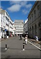
Living in BN1 2BL offers access to a range of practical amenities within close proximity. The area is served by five retail outlets, including major supermarkets like Tesco Brighton, Sainsburys Brighton, and Waitrose Brighton, ensuring everyday shopping needs are met. Nearby railway stations—London Road, Hove, and Preston Park—provide efficient transport links to Brighton’s central districts and beyond, enhancing both commuter and leisure opportunities. While the area’s historic character is defined by Regency-era architecture, its modern amenities cater to daily life, from grocery shopping to rail travel. The combination of retail options and transport infrastructure supports a convenient lifestyle, though the small postcode area means residents often integrate with surrounding neighborhoods for broader access. This balance of historic charm and practicality makes BN1 2BL appealing to those seeking coastal living without sacrificing convenience.
Amenities
Schools
The nearest school to BN1 2BL is Middle Street Primary School, which holds a 'good' Ofsted rating. This school serves the local community, providing education for younger children in the area. However, no secondary schools are listed in the data, which may require families to seek options outside BN1 2BL. The presence of a primary school with a positive rating is a key consideration for parents, though the absence of higher education institutions nearby could impact long-term family planning. The school’s rating suggests a reasonable standard of teaching and facilities, but families may need to factor in travel time or additional costs for secondary schooling. The limited range of educational institutions reflects the area’s small size and focus on transient residents, making it essential for prospective buyers to assess whether local schools meet their children’s needs.
| Rank | School | Type | Entry gender | Ages |
|---|
Explore more schools in this area
Go to Schools tabDemographics
BN1 2BL has a median age of 22, with the majority of residents aged 15–29. This reflects a community dominated by young adults, likely including students and early-career professionals. Home ownership is low at 19%, indicating that most residents rent their properties, which aligns with the area’s character as a transient district. The primary accommodation type is flats, suggesting a focus on smaller, shared living spaces. The predominant ethnic group is White, though specific data on diversity is not provided. The age profile and low home ownership suggest a dynamic, often temporary population. This demographic structure may influence local services and amenities, with a focus on short-term needs rather than long-term community development. The area’s appeal to younger residents is evident in its proximity to educational institutions and transport links, but it also raises questions about long-term stability for families or those seeking permanent housing.
Household Size
Accommodation Type
Tenure
Ethnic Group
Religion
Household Composition
Age
Household Deprivation
NS-SEC
Explore more demographic insights in this area
Go to Demographics tabPlanning
Planning Constraints
- Flood RiskPremium
- Ramsar Wetland SitesPremium
- Area of Outstanding Natural BeautyPremium
- Protected Nature ReservePremium
- Protected WoodlandPremium