Area Overview for BN1 2BJ
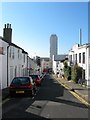
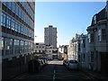
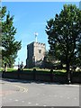
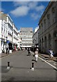
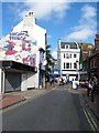
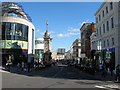
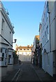
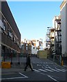
Photos of BN1 2BJ
Area Information
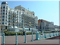
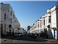
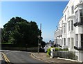
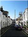
BN1 2BJ lies in the heart of Brighton’s historic Regency Ward, a seafront district defined by its architectural heritage and proximity to the coast. This small postcode area, covering 1,240 m², is home to 1,783 residents, creating a densely populated yet compact community. The area’s character is shaped by its Regency-era roots, with elegant stucco buildings and well-kept properties lining streets near landmarks like the Royal Pavilion. Despite its prestige, the ward is transient, attracting a mix of young professionals and students drawn to Brighton’s cultural vibrancy. Daily life here is punctuated by proximity to the sea, with easy access to Brighton’s promenade and the bustling city centre. The area’s small size means residents are close to amenities, but its limited housing stock—primarily flats—reflects a rental-dominated market. For those seeking a blend of history and modern convenience, BN1 2BJ offers a unique slice of Brighton’s identity, though its compact nature demands consideration of nearby areas for broader options.
- Area Type
- Postcode
- Area Size
- 1240 m²
- Population
- 1783
- Population Density
- 3976 people/km²
The property market in BN1 2BJ is characterised by a low home ownership rate—just 19% of households are owner-occupied—suggesting a strong rental market. The area’s housing stock is almost entirely composed of flats, reflecting its compact size and historical development as a residential cluster. This configuration limits the availability of larger homes or family properties, making the area more suited to single occupants or couples. Given the postcode’s small footprint, buyers should consider nearby areas for more varied housing options. The prevalence of flats also means that property values may be influenced by proximity to key amenities like transport links and schools. For those seeking ownership, the market’s rental focus may present challenges in securing long-term equity, though the area’s desirability could offer appreciation potential.
House Prices in BN1 2BJ
No properties found in this postcode.
Energy Efficiency in BN1 2BJ
Living in BN1 2BJ offers access to a range of practical amenities within close reach. The area is near several retail outlets, including Tesco Brighton, Sainsburys Brighton, and Co-op Brighton, ensuring everyday shopping needs are met. The proximity to multiple railway stations—London Road, Hove, and Preston Park—enhances mobility, allowing residents to travel swiftly to Brighton’s cultural and commercial hubs. While the area’s small size means parks and green spaces are limited, its location on Brighton’s seafront provides access to coastal walks and open areas further afield. The combination of retail convenience, transport links, and historical charm contributes to a lifestyle that balances urban practicality with the appeal of a seaside location. However, the lack of expansive public spaces within the postcode itself may require residents to seek recreational options in nearby districts.
Amenities
Schools
The nearest school to BN1 2BJ is Middle Street Primary School, which has an Ofsted rating of ‘good’. This primary school serves the local community, providing education for younger children in the area. However, no secondary schools are listed in the data, meaning families with older children may need to look beyond BN1 2BJ for comprehensive schooling. The presence of a primary school with a positive rating is a practical benefit for residents with young children, though the absence of secondary options could be a consideration for those prioritising a full range of educational facilities. The school’s ‘good’ rating indicates a standard of education that meets expectations, but families may need to supplement with private or nearby state schools for secondary education.
| Rank | School | Type | Entry gender | Ages |
|---|
Explore more schools in this area
Go to Schools tabDemographics
BN1 2BJ has a median age of 22, with the majority of residents aged 15–29. This reflects a community skewed toward young adults, likely including students and early-career professionals. Only 19% of households are owner-occupied, indicating a rental-heavy market, with flats making up the predominant accommodation type. The area’s demographic profile suggests a transient population, typical of urban centres with strong student or graduate populations. The predominant ethnic group is White, though no specific diversity statistics are provided. The high population density—1.4 million people per km²—means the area is intensely lived-in, with limited space for expansion. For residents, this density translates to a lively, fast-paced environment but also potential challenges in finding long-term housing stability. The low home ownership rate underscores the area’s role as a temporary base for those pursuing education or careers in Brighton.
Household Size
Accommodation Type
Tenure
Ethnic Group
Religion
Household Composition
Age
Household Deprivation
NS-SEC
Explore more demographic insights in this area
Go to Demographics tabPlanning
Planning Constraints
- Flood RiskPremium
- Ramsar Wetland SitesPremium
- Area of Outstanding Natural BeautyPremium
- Protected Nature ReservePremium
- Protected WoodlandPremium