Area Overview for BN1 1RU
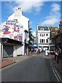
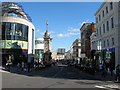
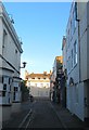
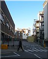
Photos of BN1 1RU
Area Information
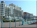
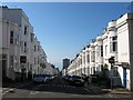
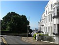
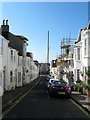
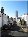
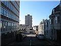
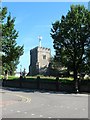
BN1 1RU lies in the heart of Brighton and Hove, within the West Hill and North Laine areas, a small residential cluster with a population of 1,846. This postcode is part of a historic district that evolved from 18th-century market gardens and industrial workshops into a vibrant, compact urban space. The area is defined by its proximity to Brighton railway station, with streets like Church Street and Bond Road reflecting its heritage as a conservation area. Daily life here is shaped by a mix of boutique shops, cafes, and terraced housing, creating a bohemian atmosphere. The low flood risk and absence of protected natural sites suggest a practical, lived-in character. However, the area’s compact size means residents are close to both the city’s cultural hubs and the quieter, hillside charm of West Hill. For those seeking a balance between urban convenience and a sense of community, BN1 1RU offers a distinct blend of historical roots and modern living, though its small scale means it’s best suited for those prioritising accessibility over expansive spaces.
- Area Type
- Postcode
- Area Size
- Not available
- Population
- 1846
- Population Density
- 6396 people/km²
BN1 1RU is characterised by a rental-dominated property market, with only 35% of homes owned by residents. The accommodation type is predominantly flats, reflecting the area’s density and historical development as a residential cluster near Brighton’s railway infrastructure. This suggests a market skewed towards short-term or long-term renters, with limited scope for owner-occupation. The small size of the postcode area means property availability is constrained, potentially driving competition among buyers. For those considering purchase, the focus would likely be on flats within terraced or converted buildings, though the lack of specific data on property prices or sizes means buyers must assess the market through local agents. The area’s proximity to transport links and amenities may offset the challenges of limited housing stock, but the rental-heavy nature of the market could affect long-term investment appeal.
House Prices in BN1 1RU
No properties found in this postcode.
Energy Efficiency in BN1 1RU
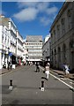
Living in BN1 1RU offers access to a range of amenities within walking distance. Five retail outlets, including Sainsburys Brighton, Co-op Brighton, and Tesco Brighton, provide everyday shopping needs, while five railway stations ensure seamless travel to surrounding areas. The area’s proximity to Brighton’s cultural and commercial centres, coupled with its historic streets, creates a lifestyle that balances convenience with character. Residents can enjoy the bohemian vibe of North Laine’s boutique shops and cafes, though the lack of larger parks or recreational spaces may require trips to nearby green areas. The compact nature of the area means daily errands and commutes are efficient, though those seeking expansive leisure facilities may need to venture beyond the postcode. The mix of retail and transport options supports a practical, urban-oriented lifestyle.
Amenities
Schools
The nearest school to BN1 1RU is St Paul’s CofE Primary School, which serves the area with a primary education offering and holds an Ofsted rating of satisfactory. This school is the sole named institution listed in the data, meaning families in the area must rely on this primary option or seek secondary education elsewhere. The absence of secondary schools within the immediate vicinity suggests that parents may need to consider commuting to nearby districts for higher education. The single primary school’s rating indicates a moderate standard of education, though specific details on curriculum or performance metrics are not provided. For families prioritising proximity to schools, the availability of only one primary option may influence their decision to explore adjacent areas with more comprehensive educational offerings.
| Rank | School | Type | Entry gender | Ages |
|---|
Explore more schools in this area
Go to Schools tabDemographics
The population of BN1 1RU is 1,846, with a median age of 47 and the majority of residents aged 30–64. This suggests a mature, stable community with a strong presence of working-age adults. Home ownership stands at 35%, indicating that a significant portion of the housing stock is rented, likely reflecting the area’s history as a mix of terraced and purpose-built flats. The predominant accommodation type is flats, aligning with the compact, urban layout of the area. The predominant ethnic group is White, though specific data on diversity beyond this is not provided. The age profile and ownership figures suggest a community that may be less transient than areas with higher rental turnover, though the 35% ownership rate implies a balance between long-term residents and those in rental properties.
Household Size
Accommodation Type
Tenure
Ethnic Group
Religion
Household Composition
Age
Household Deprivation
NS-SEC
Explore more demographic insights in this area
Go to Demographics tabPlanning
Planning Constraints
- Flood RiskPremium
- Ramsar Wetland SitesPremium
- Area of Outstanding Natural BeautyPremium
- Protected Nature ReservePremium
- Protected WoodlandPremium