Area Overview for BN1 1FZ
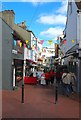
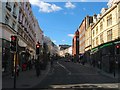
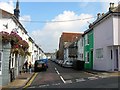
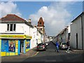
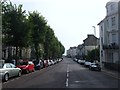
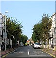
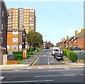
Photos of BN1 1FZ

Area Information
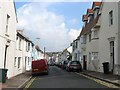
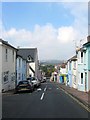
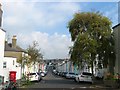
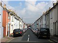
BN1 1FZ is a compact residential postcode in Brighton and Hove, encompassing part of the historic Kemp Town Estate. This area, spanning 191 m², is densely populated, with 1950 residents living in a cluster of Regency-era terraces, Victorian buildings, and modern conversions. Its location in Kemptown Ward places it at the heart of eastern Brighton, bordered by Edward Street, Eastern Road, and the Old Steine. The estate, designed in the 19th century by Thomas Read Kemp, features iconic structures like Arundel Terrace and Sussex Square, alongside private gardens and the Kemp Town Enclosures. Daily life here blends historic charm with contemporary convenience, with nearby shops, rail links, and cultural landmarks. The area’s small size means residents are close to Brighton’s amenities, including the seafront, while its compact nature fosters a tight-knit community. However, the high population density—over 10 million people per km²—reflects the area’s role as a sought-after, though limited, residential hub.
- Area Type
- Postcode
- Area Size
- 191 m²
- Population
- 1950
- Population Density
- 15790 people/km²
The property market in BN1 1FZ is characterised by a low home ownership rate of 28%, indicating that the area is primarily a rental market. The accommodation type is predominantly flats, a legacy of the 19th-century Kemp Town Estate’s terraced design and subsequent conversions into modern housing. This means the housing stock is largely uniform, with limited availability of owner-occupied properties. For buyers, this suggests that the area may not be ideal for those seeking long-term ownership, though the historic character of Regency terraces and private gardens could appeal to investors. The small size of the postcode means the immediate surroundings likely share similar housing patterns, with limited scope for new developments. Prospective buyers should consider the rental market dynamics and the potential for property value appreciation in a historically significant area.
House Prices in BN1 1FZ
Showing 2 properties
| Address | Type | Beds | Baths | Last Sale Price | Last Sale Date | |
|---|---|---|---|---|---|---|
| Second Floor Flat, 4 Old Steine, Brighton, BN1 1FZ | Flat | - | - | - | - | |
| Third Floor Flat, 4 Old Steine, Brighton, BN1 1FZ | Flat | - | - | - | - |
Energy Efficiency in BN1 1FZ
Living in BN1 1FZ offers access to a mix of retail, dining, and transport options within practical reach. Nearby shops include Sainsburys Brighton, Morrisons Kemp, and Co-op St, providing essential grocery and retail services. The area’s proximity to five rail stations—London Road, Hove, and Preston Park—ensures convenient travel for commuting or leisure. Historically, the Kemp Town Estate’s Regency terraces and private gardens add character, with landmarks like the Sassoon Mausoleum and the Kemp Town Enclosures offering unique spaces for residents. The blend of historic architecture and modern amenities creates a lifestyle that balances heritage with convenience. While the area’s small size means limited local parks, its location in Brighton ensures easy access to coastal walks and cultural attractions. The density of shops and transport options supports a dynamic, accessible daily life.
Amenities
Schools
| Rank | School | Type | Entry gender | Ages |
|---|
Explore more schools in this area
Go to Schools tabDemographics
BN1 1FZ has a median age of 47, with the majority of residents aged 30–64. This suggests a mature, stable community, likely with long-term residents and families. Home ownership is low at 28%, indicating that most residents are renters, possibly drawn by the area’s historic housing stock and proximity to amenities. The predominant accommodation type is flats, a reflection of the estate’s original design as terraced housing and later conversions into modern living spaces. The predominant ethnic group is White, though specific diversity data is not provided. The age profile and ownership rates suggest a mix of professionals and retirees, with limited data on deprivation levels. The low home ownership rate may impact long-term investment potential, while the age range indicates a community focused on established living rather than young families.
Household Size
Accommodation Type
Tenure
Ethnic Group
Religion
Household Composition
Age
Household Deprivation
NS-SEC
Explore more demographic insights in this area
Go to Demographics tabPlanning
Planning Constraints
- Flood RiskPremium
- Ramsar Wetland SitesPremium
- Area of Outstanding Natural BeautyPremium
- Protected Nature ReservePremium
- Protected WoodlandPremium