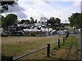
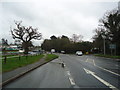
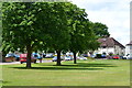
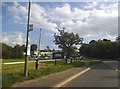
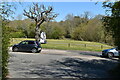
Area Overview for Blindley Heath
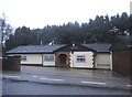
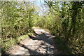
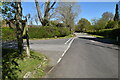
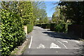
Photos of Blindley Heath


Area Information
Living in Blindley Heath means residing in a built-up area that covers 93.3 hectares. This residential pocket sits within the broader landscape of England, distinct from the surrounding countryside. The community has developed into a settled neighbourhood with its own identity, separate from major urban centres yet connected by the local transport network. You find a location defined by its manageable size and proximity to key regional hubs. Daily life here revolves around access to local services and the specific rhythm of a residential district rather than a bustling city centre. The area offers a defined scope for housing, making it a practical choice for those seeking a specific type of domestic life. The character of Blindley Heath reflects a long-established community focus. Residents benefit from a concentration of homes within a clear geographical boundary. This density allows for easier access to nearby amenities without the overwhelming pace of larger towns. The area functions as a dedicated residential zone where growth is contained within its 93.3-hectare footprint. For someone considering a move, the scale of Blindley Heath suggests a quiet, focused environment. It is a place where local streets have defined boundaries, creating a sense of place that larger sprawl cannot replicate. The area stands as a конкрет example of planned residential development in the region.
- Area Type
- Built Up Area 250
- Area Size
- 93.3 hectares
- Population
- Not available
- Population Density
- Not available
Living in Blindley Heath offers practical access to a range of amenities. You can find retail options including Budgens Blindley, Spar, and Tesco Lingfield within easy reach. Five retail outlets serve the immediate community, ensuring your daily shopping needs are met without long journeys. For rail travel, five stations are nearby, including Godstone Railway Station, Lingfield Railway Station, and Nutfield Railway Station. These points provide efficient connections to wider transport networks. Public transport extends further with a bus service located at the South Terminal Coach Station. Two metro shuttle stations connect you to Gatwick South Terminal and Gatwick North Terminal. Finally, London Gatwick Airport stands as a major nearby amenity one mile away in some contexts or simply within the regional reach. This concentration of facilities places Gatwick Airport and major retail chains at your fingertips. The variety of transport hubs means you have multiple ways to leave the area quickly. Whether you need groceries, a train ticket, or a flight, the infrastructure supports these activities directly. The layout prioritises accessibility for daily tasks and travel needs.
Amenities
Schools
Families considering Blindley Heath have several educational options within practical reach. You can access the Blindley Heath CofE First School, which serves as a primary institution for local children. For those seeking independent education, both the Trefoil Montessori School of Arts and the Trefoil Montessori School of Arts are listed as the nearest independent providers. The presence of a community first school offers a place-based educational route for younger children living in the area. The dual listing of the Trefoil Montessori School indicates it is the primary independent choice in this immediate vicinity. Schooling in this location relies on these two main pillars: state primary and independent arts-focused education. When evaluating schools near Blindley Heath, you find a small but specific selection. The Blindley Heath CofE First School addresses the primary phase for many local children. The Trefoil Montessori School of Arts offers an alternative curriculum focused on arts and independent learning. This mix provides families with a clear choice between a traditional primary setting and a specialist independent option. Both institutions are directly associated with the area, ensuring consistency in the local learning environment.
| Rank | A + A* % | School | Type | Entry gender | Ages |
|---|---|---|---|---|---|
| 1 | N/A | Blindley Heath CofE First School | primary | N/A | N/A |
| 2 | N/A | Trefoil Montessori School of Arts | independent | N/A | N/A |
| 3 | N/A | Trefoil Montessori School of Arts | independent | N/A | N/A |
Explore more schools in this area
Go to Schools tabDemographics
The community in Blindley Heath presents a distinct age profile. The median age is 70, which indicates a significant population of older residents. You are looking at a neighbourhood where the dominant age group falls into the senior category. This demographic reality shapes the social fabric of the area. A large portion of the population is settled and likely works from home or enjoys retirement living. The median age of 70 year-olds creates a stable, mature environment. This contrasts sharply with areas skews towards families or young professionals. Home ownership stands at 66% in Blindley Heath. This high figure suggests that the majority of households own their residences outright or have a substantial mortgage. You will find fewer private landlords here compared to many urban districts. Of the total households, a clear majority consists of owners rather than tenants. This statistic influences the稳定性 of the community, as owners tend to remain in one place for longer periods. The predominance of owner-occupied properties supports a steady demand for local services tailored to long-term residents. Understanding the 66% ownership rate clarifies the nature of investment and living decisions in this specific postcode. The demographic composition is clearly weighted towards older homeowners.
Household Size
Accommodation Type
Tenure
Ethnic Group
Religion
Household Composition
Age
Household Deprivation
NS-SEC
Explore more demographic insights in this area
Go to Demographics tabPlanning
Planning Constraints
- Crime RiskLocked