Area Overview for Bletchley Park Ward
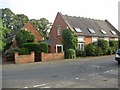
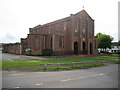
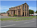
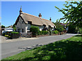
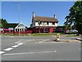
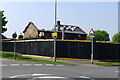
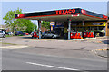
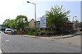
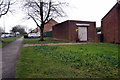
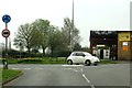
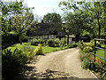
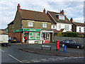
Photos of Bletchley Park Ward
Area Information
Bletchley Park Ward is a distinct electoral ward within the City of Milton Keynes unitary authority, situated in the South East of England. This compact district covers an area of 5.8 square kilometres and forms part of the Bletchley and Fenny Stratford parish. The ward represents the Bletchley area while remaining integrated into the wider Milton Keynes urban sprawl and falling under the Buckingham and Bletchley parliamentary constituency. It is home to a population of 3,435 residents, creating a close-knit community within a very small geographical footprint. The resulting population density stands at 588 people per square kilometre, which suggests a developed neighbourhood rather than open countryside. Living in Bletchley Park Ward means navigating a space where historical significance meets modern suburban planning. The ward functions as a self-contained pocket of the city, offering residents a specific locale defined by its boundary and administrative status. You will find that daily life here revolves around this defined 5.8 square kilometre zone. The concentration of people within such a limited area shapes the rhythm of the local schools, shops, and transport links. Understanding the scale of the ward helps prospective buyers visualise their potential future home. The wards map and electoral boundaries are clear, ensuring you know exactly where you stand in relation to Milton Keynes city centre and the surrounding districts.
- Area Type
- District Borough Unitary Ward
- Area Size
- 5.8 km²
- Population
- 3435
- Population Density
- 588 people/km²
Demographics
The community profile of Bletchley Park Ward is defined by a high proportion of older residents. The median age for the population is 70 years, indicating that the area attracts or retains a demographic wishing to retire. While the most common age range category is listed generally as Age Total, the specific median figure points to a mature neighbourhood. This age structure influences the needs of local amenities and the pace of social interaction. Home ownership is the dominant tenure type, with 63 per cent of households owning their property outright or with a mortgage. This figure places the area firmly in the bracket of established home owners rather than a volatile rental market. Household composition data is recorded as total, reflecting the standard categorisation used for this ward. Accommodation types are similarly recorded in total, showing the aggregate nature of the housing stock without breaking down specific building styles in the raw figures. The ward does not provide specific breakdowns for predominant ethnic groups or religious affiliations in the available data. Despite the lack of detailed diversity metrics, the high home ownership rate and older median age create a stable social environment. Residents here likely prioritise quiet streets and safe parks over high-energy nightlife or large childcare facilities. The demographic reality means that buying a home in Bletchley Park Ward often aligns with long-term retirement planning rather than a transient family move.
Household Size
Accommodation Type
Tenure
Ethnic Group
Religion
Household Composition
Age
Household Deprivation
NS-SEC
Explore more demographic insights in this area
Go to Demographics tabPlanning
Planning Constraints
- Flood RiskPremium
- Ramsar Wetland SitesPremium
- Area of Outstanding Natural BeautyPremium
- Protected Nature ReservePremium
- Protected WoodlandPremium
- Crime RiskPremium