Area Overview for Bletchingdon
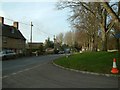
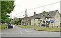
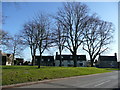
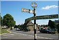
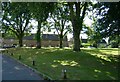
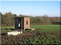
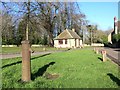
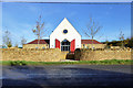
Photos of Bletchingdon


Area Information
Bletchingdon is a compact built-up area in England, covering 25 hectares and serving as a quiet, well-connected community. Its population is predominantly older, with a median age of 70, suggesting a mature demographic profile. The area is characterised by a mix of residential properties, though specific types are not detailed in the data. Bletchingdon’s proximity to nearby towns and amenities makes it a practical choice for those seeking a balance between rural tranquillity and urban convenience. Residents benefit from a low crime risk, with a safety score of 78 out of 100, indicating a secure environment. The area’s digital connectivity is strong, with a broadband score of 100 and mobile coverage rated 83, supporting both work and leisure activities. Nearby, Tackley and Islip railway stations provide links to Oxford and beyond, while London Oxford Airport and Oxford (Kidlington) Airport offer regional travel options. For families, Bletchingdon Parochial Church of England Primary School, rated good by Ofsted, is a key local institution. The community’s charm lies in its accessibility to essential services, coupled with a relatively low population density, making it appealing for those prioritising safety and connectivity.
- Area Type
- Built Up Area 250
- Area Size
- 25.0 hectares
- Population
- Not available
- Population Density
- Not available
Bletchingdon’s lifestyle is shaped by its proximity to essential amenities, including five retail outlets such as Co-op Bletchingdon and M&S Family Farm Bicester BP. These stores offer everyday shopping convenience, though the area’s small size means larger retail options may be found in nearby towns. The railway network, with stations like Tackley and Islip, provides easy access to Oxford and beyond, supporting both daily commutes and weekend travel. Two airports within practical reach—London Oxford and Oxford (Kidlington)—enhance regional connectivity. For leisure, the area’s character is defined by its quiet, mature community, with limited specific parks or recreational facilities detailed in the data. The presence of a well-rated primary school and nearby services suggests a focus on practical living over extensive leisure infrastructure. Overall, Bletchingdon offers a balanced lifestyle, combining accessibility with a low-key, secure environment.
Amenities
Schools
Bletchingdon Parochial Church of England Primary School is the sole listed school in the area, serving local families with a primary education offering. Rated ‘good’ by Ofsted, it provides a reliable educational foundation for children. The absence of secondary schools or other educational institutions in the data means families may need to look to nearby towns for further schooling. This single primary school suggests a community focused on local education, though parents seeking a broader range of schools may find Bletchingdon’s options limited. The school’s rating reflects a satisfactory standard of teaching and facilities, which is crucial for families prioritising quality education. For those considering Bletchingdon, the presence of a well-regarded primary school is a key factor, though further research into secondary schooling options in adjacent areas is advisable.
| Rank | A + A* % | School | Type | Entry gender | Ages |
|---|---|---|---|---|---|
| 1 | N/A | Bletchingdon Parochial Church of England Primary School | primary | N/A | N/A |
Explore more schools in this area
Go to Schools tabDemographics
Bletchingdon’s population has a median age of 70, with the most common age range encompassing all demographics. This suggests a community skewed towards older adults, which may influence local services and amenities. Home ownership is high, at 73 per cent, indicating a stable residential base with long-term residents. Accommodation types and household compositions are not specified in the data, but the overall profile points to a settled, less transient population. The area’s predominant ethnic group and religious composition are not detailed, though the data notes these categories as ‘total’, implying no single group dominates. The absence of specific deprivation metrics means quality of life can be inferred from other factors, such as safety and connectivity. With a low crime risk and robust digital infrastructure, Bletchingdon offers a secure, well-served environment for its residents. The combination of high home ownership and mature demographics suggests a community focused on stability rather than rapid change.
Household Size
Accommodation Type
Tenure
Ethnic Group
Religion
Household Composition
Age
Household Deprivation
NS-SEC
Explore more demographic insights in this area
Go to Demographics tabPlanning
Planning Constraints
- Crime RiskLocked