Area Overview for Blackbird Leys
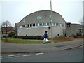
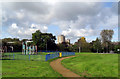
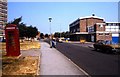
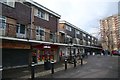
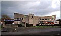
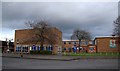
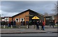
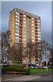
Photos of Blackbird Leys
Area Information
Blackbird Leys is a distinct civil parish located within Oxfordshire, covering a compact geographical area of 2.2 km². This small footprint supports a population of 1697 residents, resulting in a density of 760 people per square kilometre. Living in Blackbird Leys means sharing a closely knit environment where you are likely to be within minutes of your neighbours. The community feels like a true neighbourhood rather than a sprawling suburb, offering a sense of belonging that comes from proximity. When you consider exploring homes in Blackbird Leys, you are entering an established area with a clear demographic character. The limited land size means that development pressures are managed differently than in larger conurbations, creating a contained living experience. You will find that daily routines are shaped by this compact nature, where distances to local amenities are negligible. Prospective buyers appreciate that a significant portion of the region is already developed, meaning the immediate surroundings are defined and known. The parish structure provides a sense of local governance and identity that is often lost in larger urban planning zones. Understanding the scale of Blackbird Leys helps you gauge your future life here. It is an area where your journey to school or work relies less on extensive travel and more on local connectivity. The physical constraints of the 2.2 km² boundary define the character of every street and garden within the parish lines.
- Area Type
- District Borough Unitary Ward
- Area Size
- 2.2 km²
- Population
- 1697
- Population Density
- 760 people/km²
Demographics
The community in Blackbird Leys has a unique demographic profile dominated by older residents. The median age for the population stands at 70 years, indicating a heavily retired cohort. This means that when you are looking for schools near Blackbird Leys, you are primarily serving a small academic population within the parish. Most households consist of individuals living alone or couples without children, reflecting the age distribution. Home ownership is a significant factor in how the community operates, with 38% of residents owning their homes outright or with a mortgage. While nearly two-thirds of the population rents their accommodation, the level of ownership suggests a settled history for those who have stayed. You will encounter a neighbourhood where many families have lived for decades, creating deep local roots. The high concentration of older ages influences local service demand, from healthcare access to leisure activities. When you live in Blackbird Leys, you are part of a group where mobility might be less common, and where quiet evenings are the norm. The demographic makeup explains a generally peaceful atmosphere, yet the lower home ownership rate highlights a market dominated by rentals. Understanding that most residents are over the number 60 helps you appreciate the specific pace of life in this parish.
Household Size
Accommodation Type
Tenure
Ethnic Group
Religion
Household Composition
Age
Household Deprivation
NS-SEC
Explore more demographic insights in this area
Go to Demographics tabPlanning
Planning Constraints
- Flood RiskPremium
- Ramsar Wetland SitesPremium
- Area of Outstanding Natural BeautyPremium
- Protected Nature ReservePremium
- Protected WoodlandPremium
- Crime RiskPremium