Area Overview for Birchington South Ward
Photos of Birchington South Ward
Area Information
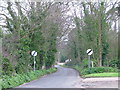
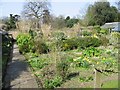
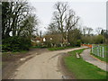
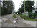
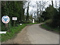
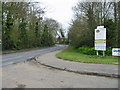
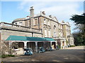
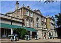
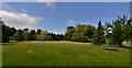
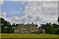
Birchington South Ward represents a distinct district within the borough, covering an area of 5.6 square kilometres. This specific ward offers a settled residential environment where daily life revolves around a mature community. The locality is defined by its compact size and established character, making it a practical choice for those seeking a quiet location within a wider town setting. When considering living in Birchington South Ward, you are entering a space designed for stability rather than rapid expansion. The ward provides a self-contained option for residents who prioritise established neighbourhoods over developing estates. Prospective buyers will find that the area supports a traditional way of life without the noise or clutter often associated with denser urban zones. You can expect an environment where local routines take precedence, offering a predictable pace for your daily activities. The ward's defined boundaries help create a sense of locality that appeals to long-term residents. Those looking for homes in Birchington South Ward should be aware that this is a mature district where the infrastructure caters to an older demographic. The area does not highlight new construction projects, but it provides a solid foundation for homeownership. This summary reflects the reality of a place where the built environment serves a specific population with existing needs. The ward stands as a clear example of a functional residential zone within the broader administrative structure. It is a location where the focus remains on the practicalities of home and garden, rather than trendy developments. Living here means embracing a lifestyle anchored in the current state of the ward rather than future speculative changes.
- Area Type
- District Borough Unitary Ward
- Area Size
- 5.6 km²
- Population
- Not available
- Population Density
- Not available
Demographics
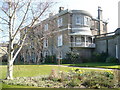
The community profile of Birchington South Ward shows a clearly defined age structure, with a median age of 70 years. This figure indicates that the ward is dominated by retirees and older adults who have likely called this area home for decades. You will find that the majority of the population falls into the older age brackets, reflecting a shift away from younger families. The demographic data confirms that this is not a hub for young professionals or students seeking vibrant nightlife or career-starting hubs. Instead, it caters to those who value the quieter aspects of later life. Homeownership stands as a dominant feature of this community, with 76 per cent of all households owning their property outright or with a mortgage. This high rate of ownership suggests a deep-rooted sense of belonging and long-term stability within the ward. Residents are likely to stay in their homes for extended periods, fostering a reliance on local services and social networks. The high level of tenure stability means that the local real estate market focuses heavily on owner-occupied sales rather than the rental sector. When examining household composition and accommodation types in Birchington South Ward, the data presents a total picture rather than specific breakdowns. However, the overall trend points towards adult families or couples living in substantial dwellings suitable for two-income retirees or single occupants. The ethnic and religious diversity figures are noted as total aggregates, meaning the ward maintains the general diversity of the county without extreme outliers. For those researching living in Birchington South Ward, the clear dominance of older homeowners creates a community dynamic focused on leisure, local amenities, and peace rather than the hustle of a bustling, multi-generational town centre.
Household Size
Accommodation Type
Tenure
Ethnic Group
Religion
Household Composition
Age
Household Deprivation
NS-SEC
Explore more demographic insights in this area
Go to Demographics tabPlanning
Planning Constraints
- Flood RiskPremium
- Ramsar Wetland SitesPremium
- Area of Outstanding Natural BeautyPremium
- Protected Nature ReservePremium
- Protected WoodlandPremium