Area Overview for Birchington
Photos of Birchington
Area Information
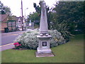
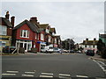
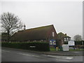
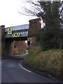
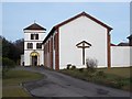
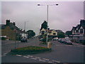
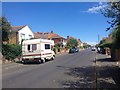
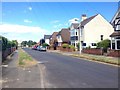
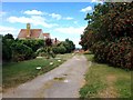
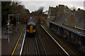
Birchington is a civil parish located on the coast of the Isle of Thanet in Kent, South East England. This small settlement covers an area of 8.4 square kilometres and houses a population of 3,760 people. The community possesses a deep historical lineage, first recorded in 1240 as Birchenton, meaning a farm where birch trees grow. Archaeological evidence confirms prehistoric, Iron Age, Roman, Saxon, and medieval activity in the vicinity, notably at Minnis Bay. Quex Park manor house was built in the early 15th century and later rebuilt in the 19th century, featuring Waterloo Tower, which served as Kent's first twelve-bell tower in 1818. All Saints' Church stands as a Grade II listed building dating back to the 13th century. The village transitioned from agricultural roots to a coastal resort in the late 19th century following the opening of the railway station on the Kent Coast line in 1863. The site remains notable for being the burial place of Pre-Raphaelite artist Dante Gabriel Rossetti and the location of England's first bungalows. Station Road acts as the historic main shopping street for the parish. Living in Birchington offers proximity to historical landmarks like the Powell-Cotton Museum and a direct link to the sea. The area combines ancient settlement patterns with a coastal resort identity established over a century and a half ago.
- Area Type
- Parish
- Area Size
- 8.4 km²
- Population
- 3760
- Population Density
- 448 people/km²
Demographics
The community profile of Birchington reflects a settled, established population. The median age for residents is 70 years, indicating a significant proportion of the population lives into or has lived to a later age. The most common age range reported is simply listed as 'Age: Total', suggesting broad demographic spread rather than a narrow youth cohort. Home ownership stands at a high level, with 80% of households owning their properties outright or with a mortgage. This figure suggests the area attracts owners seeking long-term stability rather than transient tenants. The data indicates that household composition and accommodation type figures are available in the source material but do not specify breakdowns in the provided dataset. Consequently, the housing stock is defined primarily by this high ownership rate. Ethnic and religious diversity figures are recorded as 'total' in the source, meaning the specific breakdowns are not itemised here. Despite the older median age, the area supports a functioning community with established local governance, evidenced by the active civil parish council. The population density averages 448 people per square kilometre, creating a neighbourhood feel rather than urban sprawl. You find a community where residents have likely lived for generations, contributing to the village's distinct character as a historic coastal parish.
Household Size
Accommodation Type
Tenure
Ethnic Group
Religion
Household Composition
Age
Household Deprivation
NS-SEC
Explore more demographic insights in this area
Go to Demographics tabPlanning
Planning Constraints
- Flood RiskPremium
- Ramsar Wetland SitesPremium
- Area of Outstanding Natural BeautyPremium
- Protected Nature ReservePremium
- Protected WoodlandPremium
- Crime RiskPremium