Area Overview for Bicester South & Ambrosden Ward
Photos of Bicester South & Ambrosden Ward
Area Information
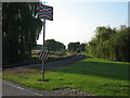
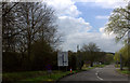
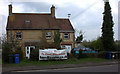
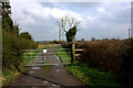
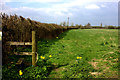
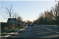
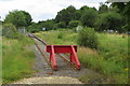
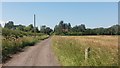
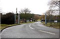
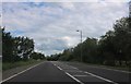
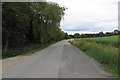
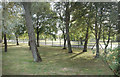
Living in Bicester South and Ambrosden Ward offers a distinct lifestyle centred on history and rural tranquillity within the Cherwell District. This electoral ward covers an area of 10.9 km² and is home to just 1,645 residents, creating a low-density environment typical of Oxfordshire villages. You will find yourself settled among the hamlets of Blackthorn and Arncott, located approximately three miles southwest of the town of Bicester near the River Ray. The parish church of St Mary the Virgin stands as a Grade II* listed medieval landmark, featuring a Norman door that hints at centuries of local continuity. Ambrosden is closely linked to the wider community via the A41 road, while the historic Bicester Military Railway provides a tangible connection to the area's industrial past. The ward encompasses the historic seat of the Page-Turner baronets, Ambrosden Park, reflecting the region's deep landed heritage. For those seeking homes in this part of South East England, the setting combines accessible road links with a preserved village atmosphere. It is a place where the rhythm of daily life is shaped by proximity to historic sites like the church and preserved woodland, rather than by high-speed urban development. The population density of 152 people per square kilometre ensures a quiet neighbourhood, suitable for those who value space and heritage.
- Area Type
- District Borough Unitary Ward
- Area Size
- 10.9 km²
- Population
- 1645
- Population Density
- 152 people/km²
Demographics
The community within Bicester South and Ambrosden Ward is defined by a distinctly mature population profile. The median age stands at 70 years, indicating that the ward is home to a significantly older demographic compared to the national average. You are likely to encounter fewer young families or students in this neighbourhood, as the resident base skews towards retirees and established adults. Home ownership is a dominant lifestyle feature, with 64% of residents owning their homes outright. This high rate suggests a community where many families have stayed for the long term or moved here specifically to settle in permanent residences rather than renting. Household composition and accommodation type statistics are not distinguished in the available data, but the ownership figures strongly imply a stock of detached and semi-detached houses suited to older living standards. The area does not report specific figures for ethnicity, religion, or detailed household breakdowns, meaning you cannot assume a wide variety of family structures or cultural backgrounds. Instead, the demographic picture is one of stability and age. Living here means joining a relatively static community where property turnover may be slower than in younger districts. This lack of demographic turbulence creates a predictable environment, though it may not suit those seeking the energy of a multi-generational, diverse neighbourhood.
Household Size
Accommodation Type
Tenure
Ethnic Group
Religion
Household Composition
Age
Household Deprivation
NS-SEC
Explore more demographic insights in this area
Go to Demographics tabPlanning
Planning Constraints
- Flood RiskPremium
- Ramsar Wetland SitesPremium
- Area of Outstanding Natural BeautyPremium
- Protected Nature ReservePremium
- Protected WoodlandPremium
- Crime RiskPremium