Area Overview for BH25 7YT
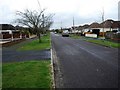
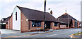
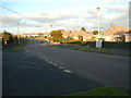
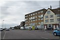
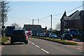
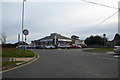
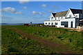
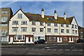
Photos of BH25 7YT

Area Information
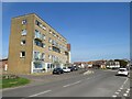
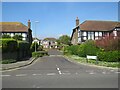
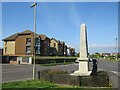
Living in BH25 7YT means inhabiting a small, tightly knit residential cluster in Hampshire, where the population of 1,883 reflects a community shaped by history and geography. Situated near Bournemouth and Christchurch, this area is part of New Milton, a market town with roots in the ancient village of Milton. The postcode encompasses a mix of traditional and modern housing, with a strong emphasis on homeownership. Daily life here is defined by proximity to coastal and rural landscapes, with easy access to nearby towns and natural features. The area’s character is anchored in its historical significance, from medieval churches to Victorian-era development spurred by the railway. While the population is relatively small, the community is stable, with a focus on low-risk living—whether in terms of safety, environmental hazards, or planning constraints. For buyers, BH25 7YT offers a quiet, secure environment with a distinct sense of place, blending small-town charm with practical modern amenities.
- Area Type
- Postcode
- Area Size
- Not available
- Population
- Not available
- Population Density
- Not available
The property market in BH25 7YT is defined by high home ownership—95% of properties are owner-occupied—suggesting a community of long-term residents with little turnover. The accommodation type is exclusively houses, which is unusual for a small postcode area but aligns with the region’s traditional housing stock. This implies a market where buyers are likely seeking family homes or retirement properties, given the elderly demographic. The limited number of properties in the area means that the local market is unlikely to be highly competitive, though buyers may need to consider nearby areas for more options. The focus on houses rather than flats or apartments also indicates a preference for private, low-density living. For those interested in BH25 7YT, the market offers stability, but buyers should be prepared for a narrow selection of properties.
House Prices in BH25 7YT
No properties found in this postcode.
Energy Efficiency in BH25 7YT
Residents of BH25 7YT have access to a range of local amenities within practical reach. Retail options include Lidl Barton on, Tesco Old, and M&S New, providing everyday shopping needs. The area’s railway stations—New Milton, Hinton Admiral, and Sway—offer convenient links to nearby towns and cities, while ferry landings at Mudeford Quay, Hengistbury Head, and Wick Christchurch provide coastal access and scenic travel routes. The presence of these services contributes to a lifestyle that balances local convenience with regional connectivity. The area’s historical and natural features, from medieval churches to coastal landscapes, add to its character, making daily life both practical and rooted in tradition. Whether for shopping, commuting, or leisure, BH25 7YT offers a mix of amenities that support a low-maintenance, community-focused lifestyle.
Amenities
Schools
| Rank | School | Type | Entry gender | Ages |
|---|
Explore more schools in this area
Go to Schools tabDemographics
The community in BH25 7YT is predominantly elderly, with a median age of 70 and the majority of residents aged 65 or older. This age profile suggests a population largely composed of retired individuals, many of whom are likely long-term residents. Home ownership is exceptionally high at 95%, indicating a stable, settled community with minimal rental activity. The accommodation type is almost entirely houses, reflecting a preference for single-family homes over flats or apartments. The predominant ethnic group is White, though specific data on diversity or deprivation is not provided. The high home ownership rate and low age of first-time buyers (implied by the elderly median age) suggest a market where properties are held by long-term occupants rather than speculative investors. For prospective buyers, this means a low turnover of properties and a focus on long-term residential needs.
Household Size
Accommodation Type
Tenure
Ethnic Group
Religion
Household Composition
Age
Household Deprivation
NS-SEC
Explore more demographic insights in this area
Go to Demographics tabPlanning
Planning Constraints
- Flood RiskPremium
- Ramsar Wetland SitesPremium
- Area of Outstanding Natural BeautyPremium
- Protected Nature ReservePremium
- Protected WoodlandPremium