Area Overview for BH25 6ST
Photos of BH25 6ST
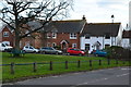
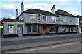
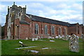
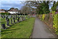
38 photos from this area
Area Information
Key information about the BH25 6ST including its size, population, and administrative classification.
- Area Type
- Postcode
- Area Size
- 1.2 hectares
- Population
- 1329
- Population Density
- 1109 people/km²
House Prices in BH25 6ST
66
Properties
£135,155
Average Sold Price
£50,500
Lowest Price
£285,000
Highest Price
Showing 66 properties
| Address | Type | Beds | Baths | Last Sale Price | Last Sale Date | |
|---|---|---|---|---|---|---|
| New Forest District Council, 6 Davis Field, New Milton, BH25 6ST | house | - | - | £285,000 | Jun 2023 | |
| 102 Davis Field, New Milton, BH25 6ST | Maisonette | 2 | - | £165,000 | Oct 2019 | |
| 8 Davis Field, New Milton, BH25 6ST | Terraced | 3 | 1 | £237,500 | Aug 2019 | |
| 72 Davis Field, New Milton, BH25 6ST | Maisonette | - | - | £148,500 | May 2017 | |
| 4 Davis Field, New Milton, BH25 6ST | Flat | - | - | £97,000 | Jan 2012 | |
| 62 Davis Field, New Milton, BH25 6ST | Flat | 2 | - | £110,000 | Jul 2008 | |
| 60 Davis Field, New Milton, BH25 6ST | Flat | - | - | £130,000 | Aug 2006 | |
| 44 Davis Field, New Milton, BH25 6ST | Flat | - | - | £127,500 | Dec 2004 | |
| 36 Davis Field, New Milton, BH25 6ST | Flat | - | - | £63,950 | Oct 2001 | |
| 12 Davis Field, New Milton, BH25 6ST | Flat | - | - | £71,750 | Mar 2001 |
Page 1 of 7
Energy Efficiency in BH25 6ST
Amenities
Schools
| Rank | School | Type | Entry gender | Ages |
|---|
Explore more schools in this area
Go to Schools tabDemographics
Household Size
Family (3-5 people)
most common
Accommodation Type
Houses
most common
Tenure
48
majority
Ethnic Group
White
most common
Religion
N/A
most common
Household Composition
N/A
most common
Age
47
median
Adults (30-64 years)
most common
Household Deprivation
N/A
with no deprivation
NS-SEC
20
in Lower managerial occupations
Explore more demographic insights in this area
Go to Demographics tabPlanning
Planning Constraints
- Flood RiskPremium
- Ramsar Wetland SitesPremium
- Area of Outstanding Natural BeautyPremium
- Protected Nature ReservePremium
- Protected WoodlandPremium