Area Overview for BH25 6QA
Photos of BH25 6QA
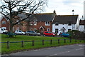
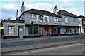
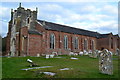
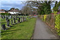
38 photos from this area
Area Information
Key information about the BH25 6QA including its size, population, and administrative classification.
- Area Type
- Postcode
- Area Size
- 3970 m²
- Population
- 1902
- Population Density
- 479071 people/km²
House Prices in BH25 6QA
10
Properties
£98,000
Average Sold Price
£80,000
Lowest Price
£120,000
Highest Price
Showing 10 properties
| Address | Type | Beds | Baths | Last Sale Price | Last Sale Date | |
|---|---|---|---|---|---|---|
| 3A Old Milton Green Parade, New Milton, BH25 6QA | Flat | 3 | - | £120,000 | Mar 2017 | |
| 5A Old Milton Green Parade, New Milton, BH25 6QA | Maisonette | 3 | 1 | £80,000 | Mar 2006 | |
| 8A Old Milton Green Parade, New Milton, BH25 6QA | Flat | - | - | £95,000 | Dec 2002 | |
| 7A Old Milton Green Parade, New Milton, BH25 6QA | Flat | - | - | £97,000 | Dec 2002 | |
| 9A Old Milton Green Parade, New Milton, BH25 6QA | undefined | - | - | - | - | |
| 6A Old Milton Green Parade, New Milton, BH25 6QA | Flat | - | - | - | - | |
| 2A Old Milton Green Parade, New Milton, BH25 6QA | Maisonette | - | - | - | - | |
| 1A Old Milton Green Parade, New Milton, BH25 6QA | Flat | - | - | - | - | |
| Jarna Tandoori Restaurant, 1 Old Milton Green Parade, New Milton, BH25 6QA | Retail | - | - | - | - | |
| 4A Old Milton Green Parade, New Milton, BH25 6QA | Maisonette | - | - | - | - |
Energy Efficiency in BH25 6QA
Amenities
Schools
| Rank | School | Type | Entry gender | Ages |
|---|
Explore more schools in this area
Go to Schools tabDemographics
Household Size
Two person
most common
Accommodation Type
Houses
most common
Tenure
80
majority
Ethnic Group
White
most common
Religion
N/A
most common
Household Composition
N/A
most common
Age
47
median
Elderly (65+ years)
most common
Household Deprivation
N/A
with no deprivation
NS-SEC
38
in Lower managerial occupations
Explore more demographic insights in this area
Go to Demographics tabPlanning
Planning Constraints
- Flood RiskPremium
- Ramsar Wetland SitesPremium
- Area of Outstanding Natural BeautyPremium
- Protected Nature ReservePremium
- Protected WoodlandPremium