Area Overview for BH25 6PT
Photos of BH25 6PT
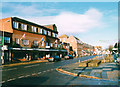
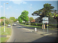
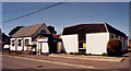
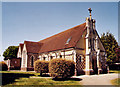
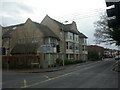
64 photos from this area
Area Information
Key information about the BH25 6PT including its size, population, and administrative classification.
- Area Type
- Postcode
- Area Size
- 5761 m²
- Population
- Not available
- Population Density
- Not available
House Prices in BH25 6PT
34
Properties
£101,500
Average Sold Price
£72,000
Lowest Price
£140,000
Highest Price
Showing 34 properties
| Address | Type | Beds | Baths | Last Sale Price | Last Sale Date | |
|---|---|---|---|---|---|---|
| 1A, Winston Parade, 55 Lymington Road, New Milton, BH25 6PT | Maisonette | - | - | £120,000 | Nov 2015 | |
| 6A, Winston Parade, 55 Lymington Road, New Milton, BH25 6PT | Flat | - | - | £140,000 | Feb 2006 | |
| 99A Lymington Road, New Milton, BH25 6PT | Flat | - | - | £72,000 | Jul 2002 | |
| 5A, Winston Parade, 55 Lymington Road, New Milton, BH25 6PT | Maisonette | - | - | £74,000 | Apr 2002 | |
| 4A, Winston Parade, 55 Lymington Road, New Milton, BH25 6PT | Maisonette | - | - | - | - | |
| 101A Lymington Road, New Milton, BH25 6PT | Flat | - | - | - | - | |
| 4, Solent Lodge, 67-69 Lymington Road, New Milton, BH25 6PT | Flat | - | - | - | - | |
| 101B Lymington Road, New Milton, BH25 6PT | Flat | - | - | - | - | |
| 1, Solent Lodge, 67-69 Lymington Road, New Milton, BH25 6PT | Flat | - | - | - | - | |
| 5, Solent Lodge, 67-69 Lymington Road, New Milton, BH25 6PT | Flat | - | - | - | - |
Page 1 of 4
Energy Efficiency in BH25 6PT
Amenities
Schools
| Rank | School | Type | Entry gender | Ages |
|---|
Explore more schools in this area
Go to Schools tabDemographics
Household Size
Two person
most common
Accommodation Type
Houses
most common
Tenure
80
majority
Ethnic Group
White
most common
Religion
N/A
most common
Household Composition
N/A
most common
Age
47
median
Elderly (65+ years)
most common
Household Deprivation
N/A
with no deprivation
NS-SEC
38
in Lower managerial occupations
Explore more demographic insights in this area
Go to Demographics tabPlanning
Planning Constraints
- Flood RiskPremium
- Ramsar Wetland SitesPremium
- Area of Outstanding Natural BeautyPremium
- Protected Nature ReservePremium
- Protected WoodlandPremium