Area Overview for BH25 6LJ
Photos of BH25 6LJ


Area Information
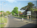
Living in BH25 6LJ means inhabiting a compact residential cluster in the heart of New Milton, a market town in Hampshire’s south coast. The area covers just 1,548 square metres, yet it is densely populated, with 1,802 residents packed into its small footprint. New Milton itself is a historic settlement with roots in the ancient village of Milton, now expanded into a modern town of around 30,000 people. Its proximity to Bournemouth, Christchurch, and the New Forest offers a blend of coastal access and rural charm. The town’s character is shaped by its Victorian-era development, spurred by the railway’s arrival in 1888. Today, BH25 6LJ residents benefit from nearby amenities, including schools, rail links, and ferry services. The area’s compact size means daily life is walkable, with a focus on community and local services. While the population is small, the density suggests a tight-knit environment, particularly given the high proportion of elderly residents. For those seeking a quiet, historic town with easy access to nature and transport, BH25 6LJ offers a distinct mix of tradition and practicality.
- Area Type
- Postcode
- Area Size
- 1548 m²
- Population
- 1802
- Population Density
- 1164369 people/km²
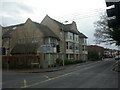
The property market in BH25 6LJ is characterised by a high rate of home ownership (74%) and a predominance of houses as the accommodation type. This suggests a market where private, owner-occupied homes dominate, rather than a rental-focused area. Given the small size of the postcode and its classification as a residential cluster, the housing stock is likely limited in scale, with properties concentrated in a compact area. The focus on houses, as opposed to flats or apartments, implies a preference for larger, more traditional homes, possibly semi-detached or detached. For buyers, this means a market where properties are likely to be long-term investments, with limited availability. The high home ownership rate also indicates a stable community, which may influence property values and desirability. However, the small size of the area means that the immediate surroundings are critical for buyers seeking more options, as the postcode itself offers a limited range of properties.
House Prices in BH25 6LJ
No properties found in this postcode.
Energy Efficiency in BH25 6LJ
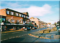
Residents of BH25 6LJ have access to a range of amenities within practical reach. Retail options include M&S New, Morrisons Daily New Milton 75, and Morrisons Tiptoe, providing everyday shopping needs. The area’s rail stations—New Milton, Hinton Admiral, and Sway—offer direct links to nearby cities, while ferry landings at Mudeford Quay, Hengistbury Head, and Lymington provide coastal access and scenic routes. The presence of these transport hubs enhances connectivity, enabling residents to explore the New Forest, the south coast, or urban centres. Locally, the mix of retail, transport, and coastal amenities creates a lifestyle that balances convenience with natural beauty. The compact nature of the area means that amenities are not overly spread out, reducing the need for long commutes. For families, the proximity of schools, shops, and transport options fosters a practical, community-oriented way of life. The blend of historic town character with modern services ensures that daily life is both functional and enriched by the surroundings.
Amenities
Schools
The schools nearest to BH25 6LJ include New Milton Infant School and New Milton Junior School, both of which are primary schools with Ofsted ratings of ‘good’. These institutions provide a seamless transition for children from early years through to primary education, covering the critical formative years. The presence of two primary schools in close proximity suggests a well-supported educational environment for families, reducing the need for long commutes. The ‘good’ Ofsted ratings indicate that both schools meet quality standards, offering a reliable foundation for young learners. For parents, this combination of school types ensures that children can remain within the same educational setting from infant to junior levels, fostering continuity and familiarity. The availability of these schools is a key consideration for families prioritising local education, as they eliminate the need to seek alternatives further afield.
| Rank | School | Type | Entry gender | Ages |
|---|
Explore more schools in this area
Go to Schools tabDemographics
The community in BH25 6LJ is predominantly elderly, with 65+ years being the most common age range, and a median age of 47. This suggests a population skewed towards older residents, though not exclusively so. Home ownership is high at 74%, indicating a stable, long-term resident base. The accommodation type is primarily houses, which aligns with the area’s compact, residential nature. The predominant ethnic group is White, though no further breakdown of diversity is provided. The population density of 1,164,369 people per square kilometre is exceptionally high for such a small area, implying a concentration of residents in limited space. This density may affect living conditions, though it also fosters a close-knit community. The high home ownership rate and focus on houses suggest a preference for private, family-oriented living rather than rental properties. For buyers, this profile indicates a market where properties are likely to be long-term holdings, with limited turnover.
Household Size
Accommodation Type
Tenure
Ethnic Group
Religion
Household Composition
Age
Household Deprivation
NS-SEC
Explore more demographic insights in this area
Go to Demographics tabPlanning
Planning Constraints
- Flood RiskPremium
- Ramsar Wetland SitesPremium
- Area of Outstanding Natural BeautyPremium
- Protected Nature ReservePremium
- Protected WoodlandPremium