Area Overview for BH25 6JH
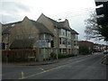
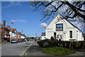
Photos of BH25 6JH


Area Information
BH25 6JH is a small residential postcode area in England, nestled within the market town of New Milton in Hampshire. With a population of 1,741, it reflects the character of a compact, tightly knit community. Situated near Bournemouth and Christchurch, the area benefits from coastal proximity, though its historical roots trace back to the ancient village of Milton, now part of the broader New Milton parish. The modern town, with a population of around 30,000, contrasts with this postcode’s smaller scale, offering a quieter, more intimate living environment. New Milton’s development was shaped by the arrival of the railway in 1888, which spurred Victorian-era growth and connected the area to major cities. Today, BH25 6JH lies along the A337 road, blending historic charm with practical access to nearby amenities. Residents here enjoy a mix of rural tranquillity and coastal convenience, with the New Forest to the north and the south coast within reach. The area’s compact nature means daily life is centred around local shops, transport links, and community hubs, making it appealing to those seeking a balanced lifestyle.
- Area Type
- Postcode
- Area Size
- Not available
- Population
- Not available
- Population Density
- Not available
The property market in BH25 6JH is characterised by a 59% home ownership rate, suggesting a balance between owner-occupied and rental properties. However, the accommodation type is predominantly flats, which may indicate a higher proportion of rental units or smaller households. This contrasts with areas where detached homes or larger properties dominate. The compact nature of the postcode area means housing options are limited to the immediate vicinity, with potential buyers needing to consider nearby towns for alternative styles of property. Flats in BH25 6JH are likely to be part of purpose-built housing or converted buildings, catering to those seeking low-maintenance living. For buyers, this market may present opportunities in the rental sector, though the small size of the area could limit competition or choice. The predominance of flats also suggests that property values may be influenced by proximity to amenities, transport links, and the town’s historic character, which could appeal to investors or first-time buyers looking for affordability.
House Prices in BH25 6JH
No properties found in this postcode.
Energy Efficiency in BH25 6JH
Living in BH25 6JH offers access to a mix of retail, transport, and coastal amenities within practical reach. The area is served by five retail outlets, including Morrisons Tiptoe and Morrisons Daily New Milton 75, as well as M&S New, providing everyday shopping convenience. Rail services are abundant, with five stations offering connections to major towns and cities, while ferry landings like Mudeford Quay and Lymington Town Quay provide direct access to the coast, ideal for leisure or commuting. The presence of New Milton Railway Station and nearby Sway Station ensures efficient travel options, while the A337 road links the area to surrounding towns. For residents, this blend of retail, transport, and coastal access creates a lifestyle that balances local convenience with regional connectivity. The proximity to the south coast also opens opportunities for outdoor activities, from walking to water-based pursuits. The compact nature of the area means amenities are clustered closely, reducing the need for long commutes and fostering a sense of community around shared local hubs.
Amenities
Schools
| Rank | School | Type | Entry gender | Ages |
|---|
Explore more schools in this area
Go to Schools tabDemographics
The community in BH25 6JH is predominantly middle-aged, with a median age of 47 and the most common age range being adults aged 30–64. This suggests a mature, stable population, likely with established careers and families. Home ownership rates stand at 59%, indicating a mix of owner-occupied and rental properties, though the exact proportion of renters is not specified. The accommodation type is primarily flats, reflecting a housing stock suited to smaller households or those prioritising convenience over space. The predominant ethnic group is White, aligning with broader demographic trends in the region. With a population of 1,741, the area is small enough to foster a close-knit community but large enough to support essential services. The absence of specific deprivation data means quality of life factors such as access to healthcare or education are not quantified here, though nearby amenities suggest reasonable provision. The demographic profile hints at a community focused on stability, with limited representation of younger or older age groups.
Household Size
Accommodation Type
Tenure
Ethnic Group
Religion
Household Composition
Age
Household Deprivation
NS-SEC
Explore more demographic insights in this area
Go to Demographics tabPlanning
Planning Constraints
- Flood RiskPremium
- Ramsar Wetland SitesPremium
- Area of Outstanding Natural BeautyPremium
- Protected Nature ReservePremium
- Protected WoodlandPremium