Area Overview for BH25 5TT
Photos of BH25 5TT
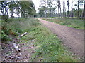
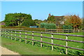
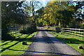
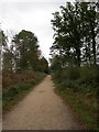
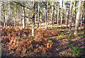
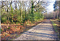
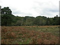
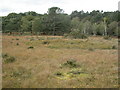
13 photos from this area
Area Information
Key information about the BH25 5TT including its size, population, and administrative classification.
- Area Type
- Postcode
- Area Size
- 45.7 hectares
- Population
- 1737
- Population Density
- 36 people/km²
House Prices in BH25 5TT
16
Properties
£1,013,667
Average Sold Price
£268,000
Lowest Price
£1,750,000
Highest Price
Showing 16 properties
| Address | Type | Beds | Baths | Last Sale Price | Last Sale Date | |
|---|---|---|---|---|---|---|
| Trefusis, Brownhill Road, Wootton, BH25 5TT | Bungalow | 5 | - | £1,250,000 | Sep 2023 | |
| Christowell, Brownhill Road, Wootton, BH25 5TT | house | 3 | 2 | £1,460,000 | Jun 2022 | |
| Smallacres, Brownhill Road, Wootton, BH25 5TT | Detached | 4 | 3 | £1,500,000 | Sep 2020 | |
| Drift House, Brownhill Road, Wootton, BH25 5TT | house | - | - | £1,200,000 | Jul 2020 | |
| Buffalo Cottage, Brownhill Road, Wootton, BH25 5TT | Detached | 3 | 2 | £425,000 | Mar 2016 | |
| Wootton Old Farm, Brownhill Road, Wootton, BH25 5TT | Detached | 5 | - | £1,750,000 | Apr 2014 | |
| Coppermead Farm, Brownhill Road, Wootton, BH25 5TT | house | - | - | £750,000 | May 2003 | |
| Yvoire, Brownhill Road, Wootton, BH25 5TT | Detached | - | - | £520,000 | May 2001 | |
| Wootton Ruff, Brownhill Road, Wootton, BH25 5TT | Detached | - | - | £268,000 | Apr 1999 | |
| Setthorns, Brownhill Road, Wootton, BH25 5TT | Detached | 4 | 3 | - | - |
Page 1 of 2
Energy Efficiency in BH25 5TT
Amenities
Schools
| Rank | School | Type | Entry gender | Ages |
|---|
Explore more schools in this area
Go to Schools tabDemographics
Household Size
Two person
most common
Accommodation Type
Houses
most common
Tenure
89
majority
Ethnic Group
White
most common
Religion
N/A
most common
Household Composition
N/A
most common
Age
47
median
Adults (30-64 years)
most common
Household Deprivation
N/A
with no deprivation
NS-SEC
54
in Lower managerial occupations
Explore more demographic insights in this area
Go to Demographics tabPlanning
Planning Constraints
- Flood RiskPremium
- Ramsar Wetland SitesPremium
- Area of Outstanding Natural BeautyPremium
- Protected Nature ReservePremium
- Protected WoodlandPremium