Area Overview for BH25 5TH
Photos of BH25 5TH
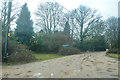
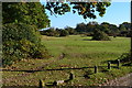
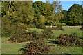
26 photos from this area
Area Information
Key information about the BH25 5TH including its size, population, and administrative classification.
- Area Type
- Postcode
- Area Size
- 31.5 hectares
- Population
- 1458
- Population Density
- 189 people/km²
House Prices in BH25 5TH
8
Properties
£750,000
Average Sold Price
£170,000
Lowest Price
£1,775,000
Highest Price
Showing 8 properties
| Address | Type | Beds | Baths | Last Sale Price | Last Sale Date | |
|---|---|---|---|---|---|---|
| Avondale, Green Lane, Ossemsley, BH25 5TH | Detached | 4 | 3 | £1,775,000 | Feb 2025 | |
| Bar Lodge, Green Lane, Ossemsley, BH25 5TH | house | - | - | £305,000 | Aug 1998 | |
| Coverts Edge, Green Lane, Ossemsley, BH25 5TH | Detached | - | - | £170,000 | Jun 1995 | |
| Desroy, Acorns, Green Lane, Ossemsley, BH25 5TH | Detached | 4 | - | - | - | |
| Lemmus, Green Lane, Ossemsley, BH25 5TH | Detached | - | - | - | - | |
| Portnalls, Green Lane, Ossemsley, BH25 5TH | house | - | - | - | - | |
| The Brambles, Green Lane, Ossemsley, BH25 5TH | Mobile Home | - | - | - | - | |
| Markway Farm, Green Lane, Ossemsley, BH25 5TH | Farm | - | - | - | - |
Energy Efficiency in BH25 5TH
Amenities
Schools
| Rank | School | Type | Entry gender | Ages |
|---|
Explore more schools in this area
Go to Schools tabDemographics
Household Size
Two person
most common
Accommodation Type
Houses
most common
Tenure
91
majority
Ethnic Group
White
most common
Religion
N/A
most common
Household Composition
N/A
most common
Age
47
median
Elderly (65+ years)
most common
Household Deprivation
N/A
with no deprivation
NS-SEC
37
in Lower managerial occupations
Explore more demographic insights in this area
Go to Demographics tabPlanning
Planning Constraints
- Flood RiskPremium
- Ramsar Wetland SitesPremium
- Area of Outstanding Natural BeautyPremium
- Protected Nature ReservePremium
- Protected WoodlandPremium