Area Overview for BH25 5LY
Photos of BH25 5LY
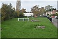
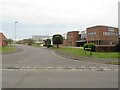
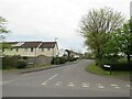
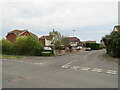
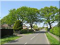
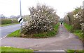
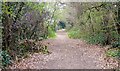
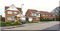
21 photos from this area
Area Information
Key information about the BH25 5LY including its size, population, and administrative classification.
- Area Type
- Postcode
- Area Size
- 1.4 hectares
- Population
- Not available
- Population Density
- Not available
House Prices in BH25 5LY
19
Properties
£283,538
Average Sold Price
£140,500
Lowest Price
£435,000
Highest Price
Showing 19 properties
| Address | Type | Beds | Baths | Last Sale Price | Last Sale Date | |
|---|---|---|---|---|---|---|
| 14 Hazelwood Avenue, New Milton, BH25 5LY | Bungalow | 2 | 1 | £330,000 | Mar 2023 | |
| 32 Hazelwood Avenue, New Milton, BH25 5LY | Bungalow | 2 | - | £362,500 | Dec 2019 | |
| 30 Hazelwood Avenue, New Milton, BH25 5LY | Bungalow | 3 | 1 | £435,000 | Nov 2019 | |
| 4 Hazelwood Avenue, New Milton, BH25 5LY | Bungalow | 4 | 2 | £420,000 | Feb 2019 | |
| 8 Hazelwood Avenue, New Milton, BH25 5LY | Bungalow | 3 | - | £378,000 | Oct 2016 | |
| 18 Hazelwood Avenue, New Milton, BH25 5LY | Bungalow | 3 | - | £310,000 | Oct 2013 | |
| 26 Hazelwood Avenue, New Milton, BH25 5LY | Retail | 3 | 1 | £245,000 | Feb 2011 | |
| 22 Hazelwood Avenue, New Milton, BH25 5LY | Bungalow | 3 | 3 | £290,000 | May 2009 | |
| 20 Hazelwood Avenue, New Milton, BH25 5LY | Bungalow | 2 | 2 | £230,000 | Nov 2004 | |
| 38 Hazelwood Avenue, New Milton, BH25 5LY | Bungalow | - | - | £240,000 | Nov 2004 |
Page 1 of 2
Energy Efficiency in BH25 5LY
Amenities
Schools
| Rank | School | Type | Entry gender | Ages |
|---|
Explore more schools in this area
Go to Schools tabDemographics
Household Size
Two person
most common
Accommodation Type
Houses
most common
Tenure
83
majority
Ethnic Group
White
most common
Religion
N/A
most common
Household Composition
N/A
most common
Age
47
median
Adults (30-64 years)
most common
Household Deprivation
N/A
with no deprivation
NS-SEC
34
in Lower managerial occupations
Explore more demographic insights in this area
Go to Demographics tabPlanning
Planning Constraints
- Flood RiskPremium
- Ramsar Wetland SitesPremium
- Area of Outstanding Natural BeautyPremium
- Protected Nature ReservePremium
- Protected WoodlandPremium