Area Overview for BH25 5EH
Photos of BH25 5EH
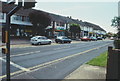

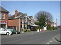


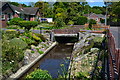

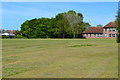
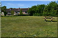
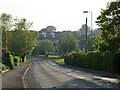
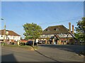
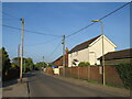
24 photos from this area
Area Information
Key information about the BH25 5EH including its size, population, and administrative classification.
- Area Type
- Postcode
- Area Size
- 8660 m²
- Population
- Not available
- Population Density
- Not available
House Prices in BH25 5EH
12
Properties
£349,928
Average Sold Price
£175,000
Lowest Price
£538,750
Highest Price
Showing 12 properties
| Address | Type | Beds | Baths | Last Sale Price | Last Sale Date | |
|---|---|---|---|---|---|---|
| 83 Manor Road, Ashley, New Milton, BH25 5EH | Bungalow | 3 | 2 | £538,750 | Jan 2025 | |
| 81 Manor Road, Ashley, New Milton, BH25 5EH | Bungalow | 3 | 1 | £465,100 | Sep 2021 | |
| 122 Manor Road, Ashley, New Milton, BH25 5EH | Bungalow | 2 | - | £362,000 | Aug 2021 | |
| 120 Manor Road, Ashley, New Milton, BH25 5EH | house | - | - | £377,500 | Jun 2021 | |
| 79 Manor Road, Ashley, New Milton, BH25 5EH | Detached | 3 | - | £480,000 | May 2020 | |
| 128 Manor Road, Ashley, New Milton, BH25 5EH | Bungalow | 3 | 2 | £289,000 | Jul 2015 | |
| 87 Manor Road, Ashley, New Milton, BH25 5EH | Detached | - | - | £272,000 | May 2007 | |
| 126 Manor Road, Ashley, New Milton, BH25 5EH | Bungalow | 3 | 1 | £190,000 | Nov 2005 | |
| 85 Manor Road, Ashley, New Milton, BH25 5EH | Bungalow | - | - | £175,000 | Jun 2002 | |
| 89A Manor Road, Ashley, New Milton, BH25 5EH | Bungalow | - | - | - | - |
Page 1 of 2
Energy Efficiency in BH25 5EH
Amenities
Schools
| Rank | School | Type | Entry gender | Ages |
|---|
Explore more schools in this area
Go to Schools tabDemographics
Household Size
Two person
most common
Accommodation Type
Houses
most common
Tenure
92
majority
Ethnic Group
White
most common
Religion
N/A
most common
Household Composition
N/A
most common
Age
47
median
Adults (30-64 years)
most common
Household Deprivation
N/A
with no deprivation
NS-SEC
36
in Lower managerial occupations
Explore more demographic insights in this area
Go to Demographics tabPlanning
Planning Constraints
- Flood RiskPremium
- Ramsar Wetland SitesPremium
- Area of Outstanding Natural BeautyPremium
- Protected Nature ReservePremium
- Protected WoodlandPremium