Area Overview for BH24 3NJ
Photos of BH24 3NJ
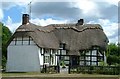
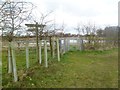
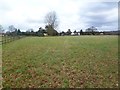
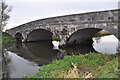
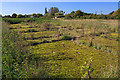
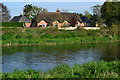
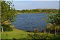
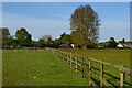
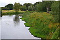
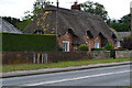
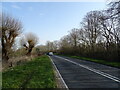
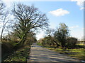
26 photos from this area
Area Information
Key information about the BH24 3NJ including its size, population, and administrative classification.
- Area Type
- Postcode
- Area Size
- 5.9 hectares
- Population
- 1168
- Population Density
- 22 people/km²
House Prices in BH24 3NJ
26
Properties
£454,747
Average Sold Price
£135,000
Lowest Price
£979,000
Highest Price
Showing 26 properties
| Address | Type | Beds | Baths | Last Sale Price | Last Sale Date | |
|---|---|---|---|---|---|---|
| Terra Nova, New Road, Mockbeggar, BH24 3NJ | Detached | 5 | 3 | £979,000 | Aug 2025 | |
| Coombe House, New Road, Mockbeggar, BH24 3NJ | house | 4 | - | £840,000 | Jun 2022 | |
| Manda, New Road, Mockbeggar, BH24 3NJ | Bungalow | - | - | £533,000 | Jun 2021 | |
| Meadow Walk, New Road, Mockbeggar, BH24 3NJ | Bungalow | 3 | - | £599,950 | Dec 2020 | |
| Edgemoor, 6 New Road, Mockbeggar, BH24 3NJ | Bungalow | - | - | £455,000 | Nov 2018 | |
| Meadow View, New Road, Mockbeggar, BH24 3NJ | Chalet | 5 | - | £685,000 | Jul 2017 | |
| Woodville, New Road, Mockbeggar, BH24 3NJ | Bungalow | - | - | £360,000 | Oct 2016 | |
| Firethorns, New Road, Mockbeggar, BH24 3NJ | Bungalow | - | - | £465,000 | Mar 2014 | |
| Eastfield, New Road, Mockbeggar, BH24 3NJ | Bungalow | - | - | £330,000 | Sep 2011 | |
| Clarendon Lodge, 15 New Road, Mockbeggar, BH24 3NJ | Bungalow | - | - | £475,000 | Sep 2010 |
Page 1 of 3
Energy Efficiency in BH24 3NJ
Amenities
Schools
| Rank | School | Type | Entry gender | Ages |
|---|
Explore more schools in this area
Go to Schools tabDemographics
Household Size
Two person
most common
Accommodation Type
Houses
most common
Tenure
81
majority
Ethnic Group
White
most common
Religion
N/A
most common
Household Composition
N/A
most common
Age
47
median
Adults (30-64 years)
most common
Household Deprivation
N/A
with no deprivation
NS-SEC
45
in Lower managerial occupations
Explore more demographic insights in this area
Go to Demographics tabPlanning
Planning Constraints
- Flood RiskPremium
- Ramsar Wetland SitesPremium
- Area of Outstanding Natural BeautyPremium
- Protected Nature ReservePremium
- Protected WoodlandPremium