Area Overview for BH23 8DF
Photos of BH23 8DF
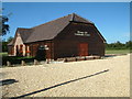
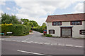
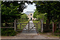
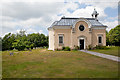
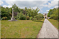
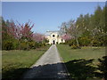
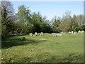
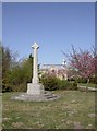

35 photos from this area
Area Information
Key information about the BH23 8DF including its size, population, and administrative classification.
- Area Type
- Postcode
- Area Size
- 31.5 hectares
- Population
- 1483
- Population Density
- 64 people/km²
House Prices in BH23 8DF
15
Properties
£479,625
Average Sold Price
£222,500
Lowest Price
£950,000
Highest Price
Showing 15 properties
| Address | Type | Beds | Baths | Last Sale Price | Last Sale Date | |
|---|---|---|---|---|---|---|
| Dial Court, 198 Burley Road, Bransgore, BH23 8DF | Detached | 5 | 4 | £950,000 | Jun 2015 | |
| 208 Burley Road, Bransgore, BH23 8DF | Bungalow | 2 | 1 | £222,500 | Oct 2012 | |
| Vatchers Farm, 219 Burley Road, Bransgore, BH23 8DF | house | - | - | £499,000 | Oct 2007 | |
| 216 Burley Road, Bransgore, BH23 8DF | Detached | - | - | £247,000 | Jun 1998 | |
| 199 Burley Road, Bransgore, BH23 8DF | Detached | 4 | 2 | - | - | |
| Hollybank, 200 Burley Road, Bransgore, BH23 8DF | Detached | 4 | 2 | - | - | |
| Shangri-la, 206 Burley Road, Bransgore, BH23 8DF | Bungalow | 3 | 2 | - | - | |
| Pine View, 204 Burley Road, Bransgore, BH23 8DF | Detached | 3 | 1 | - | - | |
| Annexe, Hill Farm, 202 Burley Road, Bransgore, BH23 8DF | Flat | - | - | - | - | |
| Mma, Office, 199 Burley Road, Bransgore, BH23 8DF | Office | - | - | - | - |
Page 1 of 2
Energy Efficiency in BH23 8DF
Amenities
Schools
| Rank | School | Type | Entry gender | Ages |
|---|
Explore more schools in this area
Go to Schools tabDemographics
Household Size
Family (3-5 people)
most common
Accommodation Type
Houses
most common
Tenure
75
majority
Ethnic Group
White
most common
Religion
N/A
most common
Household Composition
N/A
most common
Age
47
median
Adults (30-64 years)
most common
Household Deprivation
N/A
with no deprivation
NS-SEC
42
in Lower managerial occupations
Explore more demographic insights in this area
Go to Demographics tabPlanning
Planning Constraints
- Flood RiskPremium
- Ramsar Wetland SitesPremium
- Area of Outstanding Natural BeautyPremium
- Protected Nature ReservePremium
- Protected WoodlandPremium