Area Overview for Bewbush & North Broadfield Ward
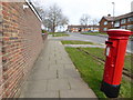
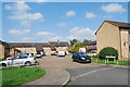
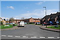
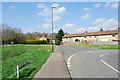
Photos of Bewbush & North Broadfield Ward
Area Information
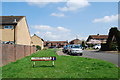
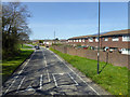
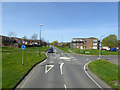
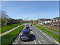
Living in Bewbush & North Broadfield Ward offers a specific type of settlement defined by its compact size and established character. This district borough unitary ward covers just 1.6 km², creating a tight-knit environment close to the Southern homesthe Wadhurst train station. You are stepping into a smaller, restrictive boundary where the physical layout dictates daily life. The area sits within the Borough of Crawley, though its boundaries remain distinct in local consciousness. When you look at the median age of residents as 70, the character shifts immediately. This is not a dynamic hub for young professionals; it is a place defined by its senior population. You will find a community where life moves at a different pace than in neighbouring, faster-paced Crawley towns. The sheer density of older residents creates a quiet atmosphere, distinct from the more mixed-age groups found across West Sussex. If you are considering homes in Bewbush & North Broadfield Ward, you are entering a sector dominated by retirement and long-term residency. There are no vacant lots; the area is fully built out within its modest footprint. This historical concentration means you are buying into a legacy environment rather than a developing one. The ward exists as a specific administrative unit, separate from Broadfield to the west, which helps maintain its unique identity. You will live in a place where the streets are familiar to a generation that has called this area home for decades.
- Area Type
- District Borough Unitary Ward
- Area Size
- 1.6 km²
- Population
- Not available
- Population Density
- Not available
Demographics
The community in Bewbush & North Broadfield Ward is demographics, the population shows a starkly skewed age profile. The median age stands at 70, a figure that defines the rhythm of daily interactions. You will encounter a resident base where older individuals are the norm rather than the exception. Half of the households in the ward are owner-occupied, a statistic that suggests stability and long-term roots rather than transient renting. This high level of home ownership indicates that many locals have settled permanently within this 1.6 km² area. The data points to a settlement where people stay for life, building deep connections with their neighbours and local services. You are buying into an environment where the workforce is largely retired and the local tenant base is smaller than the purchased market. The absence of specific breakdowns for household composition types like single-person or family units suggests a homogenous structure where the older demographic likely lives alone or with partners. There are no constraints from protected nature reserves or Ramsar sites impacting the living space, meaning the demographic makeup is driven purely by housing stock and location. The ward operates independently of broader ethnic and religious trend data which often varies by large wards, but the core fact remains clear. It is an older population living in a static environment. If you are looking for a diverse mix of young families or students, Bewbush & North Broadfield Ward does not match those criteria. You are entering a sanctuary for older generations who have chosen this specific ward for their retirement years.
Household Size
Accommodation Type
Tenure
Ethnic Group
Religion
Household Composition
Age
Household Deprivation
NS-SEC
Explore more demographic insights in this area
Go to Demographics tabPlanning
Planning Constraints
- Flood RiskPremium
- Ramsar Wetland SitesPremium
- Area of Outstanding Natural BeautyPremium
- Protected Nature ReservePremium
- Protected WoodlandPremium
- Crime RiskPremium