Area Overview for Beaulieu
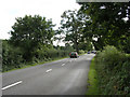
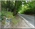
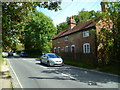
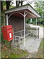
Photos of Beaulieu


Area Information
Living in Beaulieu offers a compact, well-connected experience within a built-up area spanning 22.5 hectares in England. The area’s character is shaped by its proximity to transport links, including five railway stations and multiple ferry terminals, which provide easy access to nearby towns and coastal routes. With a median age of 70, the community is predominantly older, reflecting a demographic profile that prioritises stability and established living. Home ownership here stands at 61%, suggesting a mix of long-term residents and those seeking semi-rural living close to urban amenities. Daily life in Beaulieu is defined by its practical connectivity: residents can reach major destinations via rail or ferry, while local shops like Tesco Hythe and Co-op Holbury cater to everyday needs. The area’s safety score of 69/100 indicates a lower crime risk, adding to its appeal for those seeking a secure, low-maintenance lifestyle. Though small, Beaulieu’s infrastructure supports both residential comfort and access to broader regional networks, making it a viable choice for buyers looking for a tranquil yet connected environment.
- Area Type
- Built Up Area 250
- Area Size
- 22.5 hectares
- Population
- Not available
- Population Density
- Not available
Residents of Beaulieu have access to a variety of local amenities within practical reach. Retail options include Tesco Hythe and Co-op Holbury, providing essential shopping needs. The area’s rail network, with stations such as Brockenhurst and Lymington Pier, facilitates easy travel to nearby towns and cities, while ferry terminals like Hythe and Southampton connect to coastal routes and intercity services. The presence of a coach station adds flexibility for longer-distance travel. For leisure, the proximity to ferry services suggests opportunities for boating or day trips to nearby attractions. The combination of retail, transport, and coastal access creates a lifestyle that balances convenience with regional connectivity, ideal for those seeking a mix of local comfort and broader mobility.
Amenities
Schools
| Rank | A + A* % | School | Type | Entry gender | Ages |
|---|
Explore more schools in this area
Go to Schools tabDemographics
Beaulieu’s population is predominantly older, with a median age of 70, reflecting a community where retirement and long-term residency are common. The home ownership rate of 61% suggests a significant portion of residents are homeowners, though the data does not specify the proportion of rental properties. Household composition and accommodation types are not detailed, but the overall profile indicates a stable, low-turnover demographic. The area’s age profile means services and amenities may cater more to older residents, though no specific data on healthcare or social facilities is provided. The absence of detailed figures on ethnic diversity or religious composition means the community’s cultural makeup remains unspecified. For prospective buyers, the demographic profile highlights a mature population, which may influence local services and social dynamics.
Household Size
Accommodation Type
Tenure
Ethnic Group
Religion
Household Composition
Age
Household Deprivation
NS-SEC
Explore more demographic insights in this area
Go to Demographics tabPlanning
Planning Constraints
- Crime RiskLocked