Area Overview for Beacon Road Ward
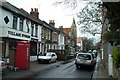
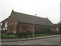
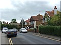
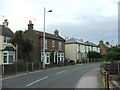
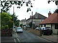
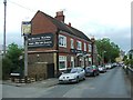
Photos of Beacon Road Ward
Area Information
Living in Beacon Road Ward offers a distinct experience within the town council boundaries of Broadstairs and St Peter's. This electoral ward sits within the Thanet District of Kent, adjacent to neighbouring areas such as Kingsgate, St. Peter's, Bradstowe, and Viking. The locality spans just 1.5 km², creating a compact community where daily routines remain manageable. You are situated on the Isle of Thanet, a geographic position that defines the local identity and outlook toward the sea. The ward functions as a defined unit under the local governance of Broadstairs and St Peter's Town Council, integrating seamlessly with surrounding electoral divisions. Those considering homes in Beacon Road Ward should note the concentrated nature of the neighbourhood. The small footprint means that amenities and services are likely within close walking or cycling distance, although specific storefronts are not detailed in current records. The area is characterised by its administrative boundaries rather than a sprawling layout, which often appeals to those seeking a contained environment. Daily life here is grounded in the reality of a historic ward within East Kent, providing a settled context for new residents. The focus remains on the practicalities of living within this specific section of the coast, balancing community proximity with the broader regional identity of Thanet.
- Area Type
- District Borough Unitary Ward
- Area Size
- 1.5 km²
- Population
- Not available
- Population Density
- Not available
Demographics
The community in Beacon Road Ward reflects a specific demographic profile consistent with retirement or older adult living. The median age across the ward stands at 70 years, significantly higher than the national average. This indicates a population heavily weighted toward the senior age bracket, suggesting a quiet, established environment. Unlike areas with a broad mix of families and young professionals, this ward is dominated by older residents who have likely lived there for decades. The household composition data is not explicitly broken down in the available records, but the age profile strongly implies single-occupancy households or those with dependent children living nearby rather than large multi-generational family units. Homeownership is a central feature of life here, with 66% of households owning their property outright or with a mortgage. This high rate signals stability and a long-term commitment to the neighbourhood. You will find a population that has stayed through various market cycles, resulting in deep local knowledge and established social networks. The lack of data on predominant ethnic groups, religious affiliation, or specific household breakdowns means the demographic picture relies heavily on the central age statistic. For buyers, this translates to a community where decision-making and community governance often reflect the needs and perspectives of an older generation. The term "neighbourhood" applies best to this location, as it is defined by long-term residency rather than transient or rapidly shifting demographics.
Household Size
Accommodation Type
Tenure
Ethnic Group
Religion
Household Composition
Age
Household Deprivation
NS-SEC
Explore more demographic insights in this area
Go to Demographics tabPlanning
Planning Constraints
- Flood RiskPremium
- Ramsar Wetland SitesPremium
- Area of Outstanding Natural BeautyPremium
- Protected Nature ReservePremium
- Protected WoodlandPremium
- Crime RiskPremium