Area Overview for Beach Ward
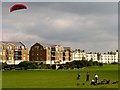
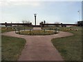
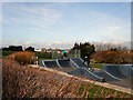
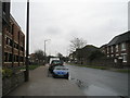
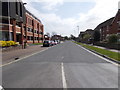
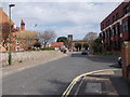
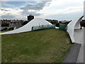
Photos of Beach Ward

Area Information
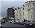
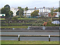
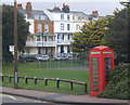
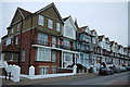
Beach Ward is a distinct district within Fareham, Hampshire, covering a total area of 1.3 square kilometres. It stands as a compact urban ward where residents navigate daily life within a tightly defined local boundary. The sheer size of this neighbourhood means that nowhere in the world is it larger, which instantly defines the scale of the community experience for everyone living in Beach Ward. You will find a setting that is entirely contained, yet the character of the place is defined by the people who call it home rather than by vast landscapes. This is a locality where the limits of the ward are clear, creating a specific environment for those seeking homes in Beach Ward. The area operates as a functional borough unitary ward, meaning it is a self-contained administrative entity with its own governance structures. Your day-to-day existence here revolves around a singular, small footprint that concentrates the local population. While the geography is modest, the reality of living in Beach Ward involves engaging with a established community structure. The physical dimensions of 1.3 km² dictate that travel between the road and any other necessary local amenity happens quickly, but the true nature of the place emerges from how residents interact within this enclosed space. Your understanding of the neighbourhood must start with the fact that it is a specific ward unit within the wider county of England. The density and layout are fixed by the boundary lines that distinguish this district from its neighbours. When you consider purchasing a home here, you are buying into a specific slice of Hampshire life that is defined by its small size and clear administrative status. There is no ambiguity about the geography; the ward is small, and its character comes from the direct engagement with your immediate surroundings.
- Area Type
- District Borough Unitary Ward
- Area Size
- 1.3 km²
- Population
- Not available
- Population Density
- Not available
Demographics
The social fabric of Beach Ward is defined by an older population, with a median age reaching seventy years. This data point indicates that the majority of the residents are senior citizens, creating a demographic profile distinct from younger urban centres. If you are looking to live in Beach Ward, you need to understand that the community consists largely of people aged seventy and above. The specific breakdown shows that the total age group represents the most common range, reinforcing that the people living here are principally of older age. Home ownership stands at a high level, accounting for seventy-three percent of the area's houses. This figure confirms that you are significantly more likely to be buying a property than renting one if you move to Beach Ward. The majority of the stock is owned outright or via a mortgage held by the previous generation or those who have stayed put. This seventy-three percent ownership rate shapes the local economy and suggests a stable, long-term resident base rather than a transient rental market. The people here have invested in their homes for decades, which influences the cultural and social rhythm of the thoroughfares. You will encounter a community where the people have deep roots in the ward. The household composition, accommodation types, and predominant ethnic group all fall under total figures that reflect this broad demographic concentration. The statistics show that the residents are primarily people living in older homes, reflecting the age profile of the demographic. Your experience in Beach Ward will be shaped by neighbours who have known each other for a long time. The high ownership percentage means that disputes over property changes are less common, and the sense of belonging is tied to legacy ownership.
Household Size
Accommodation Type
Tenure
Ethnic Group
Religion
Household Composition
Age
Household Deprivation
NS-SEC
Explore more demographic insights in this area
Go to Demographics tabPlanning
Planning Constraints
- Flood RiskPremium
- Ramsar Wetland SitesPremium
- Area of Outstanding Natural BeautyPremium
- Protected Nature ReservePremium
- Protected WoodlandPremium
- Crime RiskPremium