Area Overview for Basildon
Photos of Basildon


Area Information
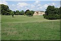
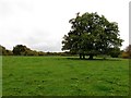
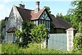
Basildon stands as a distinctive unitary district and borough within England covering 13.7 km². The area offers a specific living environment defined by its compact size and established residential character. You will find yourself in a neighbourhood where the focus is on settled communities rather than rapid expansion. The characteristics of living in Basildon centre on stability and local infrastructure within a clearly defined boundary. Residents enjoy a clear understanding of their surroundings because the area maintains its current footprint without significant planned additions. Daily life revolves around the amenities available within these administrative limits. The area represents a choice for those who prefer a contained locale rather than sprawling metropolitan settings. Homebuyers searching for homes in Basildon are entering an environment where the scope remains fixed at 13.7 km² of developed and green space. This definition provides a predictable setting for families and individuals seeking a routine lifestyle. The district operates as a self-contained entity with its own governance and planning constraints. You will experience a place where the boundaries are well understood by both planners and residents alike. The area functions effectively because its size supports a manageable network of services and transport links. Living in Basildon means accepting an area where growth has been defined and specific zones are designated for various uses.
- Area Type
- District Borough Unitary Ward
- Area Size
- 13.7 km²
- Population
- Not available
- Population Density
- Not available
Demographics
The community in Basildon reflects a mature settlement with a distinct age profile. The median age for residents is 70 years, indicating a population skewed towards older individuals. The demographic breakdown identifies the total age group as the most common segment within the area. This implies a steady demographic without large influxes of very young children or teenagers forming the majority. Home ownership stands at a high 80 per cent of all households. This figure signifies that the vast majority of residents hold their own properties free from long-term rental agreements. You will encounter a community where financial independence and property investment are common themes. The high ownership rate suggests stability and a long-term commitment to the local neighbourhood. Accommodation types in Basildon are not fragmented by a dominant rental sector; instead, the stock is primarily owned homes. The household composition data reflects this stability through a focus on established living arrangements. Diversity metrics within the area show a predominance in certain ethnic groups, though specific figures beyond the total category are not detailed. The religious makeup also follows the total demographic pattern without extreme segmentation. When considering deprivation, the area does not present a skewed disparity based on the available ownership statistics. The data points to a community where wealth is tied closely to the property market rather than transient income. Living in Basildon means joining a group of neighbours who largely own their homes. This ownership model often correlates with better maintenance and a stronger sense of civic responsibility among residents.
Household Size
Accommodation Type
Tenure
Ethnic Group
Religion
Household Composition
Age
Household Deprivation
NS-SEC
Explore more demographic insights in this area
Go to Demographics tabPlanning
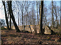
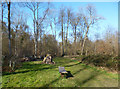
Planning Constraints
- Flood RiskPremium
- Ramsar Wetland SitesPremium
- Area of Outstanding Natural BeautyPremium
- Protected Nature ReservePremium
- Protected WoodlandPremium
- Crime RiskPremium