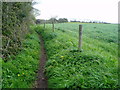
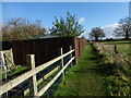
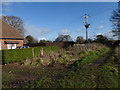
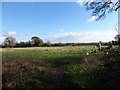
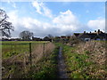
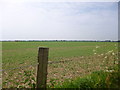
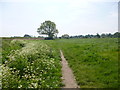
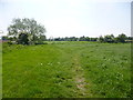
Area Overview for Barnham Ward
Photos of Barnham Ward
Area Information
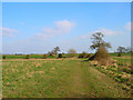
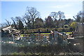
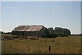
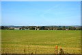
Barnham Ward covers an area of 15.9 km² within the borough unitary structure of England. You will find homes in Barnham Ward situated in a district that balances established settlement with surrounding green space. Daily life here reflects a mature environment where the median age of residents reaches 70 years. This demographic profile suggests a community accustomed to a slower pace than younger urban centres might offer. The neighbourhood functions as a distinct unit within the wider local administrative framework. Living in Barnham Ward means navigating an area defined by its senior population and significant levels of home ownership. You should expect a community where long-term settlement is common rather than transient living arrangements. The prevailing atmosphere supports older adults who value stability and proximity to established amenities. Space in Barnham Ward is sufficient for residential needs despite its relatively compact footprint compared to larger districts. Residents benefit from a layout that encourages quiet neighbourhoods rather than high-density congestion. Properties in this ward cater primarily to those seeking retirement-focused living or second homes. The architectural character likely mirrors the preferences of an older demographic, though specific building dates are not detailed in current records. You will find that the social fabric of Barnham Ward revolves around established routines and local familiarity. There is no central commercial hub mentioned, so daily shopping likely requires travel to nearby larger towns. The ward maintains its identity through low population density and a deep connection to the land.
- Area Type
- District Borough Unitary Ward
- Area Size
- 15.9 km²
- Population
- Not available
- Population Density
- Not available
Demographics
The community in Barnham Ward is defined by its advanced age profile, with a median age of 70 years. This statistic confirms that the primary residents are seniors who have likely lived in the area for decades. The total age distribution heavily favours this older demographic, creating a distinct social dynamic compared to national averages. Household composition supports this observation, indicating family units are smaller and often consist of single occupants or couples. Home ownership stands at 79% within the ward, which is a notably high figure for any English district. This rate confirms that the vast majority of residents have invested in their local property. You are unlikely to encounter a high number of private rentals in Barnham Ward. Accommodation types reflect the needs of an older population, likely featuring homes with single-story layouts or adapted features, though specific types are not individually broken down in the data. The total household composition remains stable, driven by these owner-occupied figures. Ethnic diversity data is limited to total population figures, making precise breakdowns unavailable in the current records. However, the stability of the 79% home ownership rate suggests a established, perhaps traditional, community. Deprivation indicators are not explicitly scored in the provided assessments, but the low crime risk suggests a well-maintained area. With a safety score of 69 out of 100, living in Barnham Ward offers relative security. This low crime rate contrasts with the older demographic, showing that seniors often create tight-knit neighbourhoods that look out for one another. The community feels insulated and self-reliant.
Household Size
Accommodation Type
Tenure
Ethnic Group
Religion
Household Composition
Age
Household Deprivation
NS-SEC
Explore more demographic insights in this area
Go to Demographics tabPlanning
Planning Constraints
- Flood RiskPremium
- Ramsar Wetland SitesPremium
- Area of Outstanding Natural BeautyPremium
- Protected Nature ReservePremium
- Protected WoodlandPremium