Area Overview for Barming
Photos of Barming


Area Information
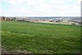
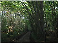
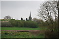
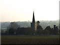
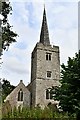
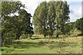
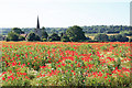
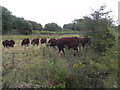
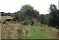
Barming is a civil parish situated in the Maidstone District of Kent, extending four-point-three square kilometres westward from Maidstone's core. While the eastern end integrates with Maidstone's built-up area, the remainder of the parish retains more rural characteristics. The River Medway forms its southern boundary, defining the landscape's edge. At the 2011 census, the population stood at 2,690 residents. This figure reflects a community that has evolved from its historic roots mentioned in the Domesday Book, where East and West Barming were originally separate parishes. They eventually merged around 1932 or 1934. Today, you will find a distinct mix where suburban living meets countryside tranquility. Key landmarks such as St Margaret's Church, dating to Norman origins, anchor the local identity alongside historical sites like the Cuthberths Cottages. Daily life here involves access to local amenities including The Fountain Inn and The Redstart, as well as a primary school and post office. The area offers a practical test of connectivity with East Farleigh railway station located within the parish on the Medway Valley Line. Prospective buyers should appreciate that living in Barming provides a grounded experience without the noise of a major urban centre, balanced by proximity to Maidstone's services.
- Area Type
- Parish
- Area Size
- 4.3 km²
- Population
- Not available
- Population Density
- Not available
Demographics
The community in Barming reflects a mature population with a median age of 70 years. This demographic profile indicates a neighbourhood where many residents value stability and established local ties. You will find that life here is likely quiet, with fewer families playing outside compared to younger districts. Household composition points towards independence or multi-generational living rather than single-person households or young professional clusters. Ownership patterns strongly favour residents who have plastered and painted their own walls; seventy-seven percent of homes are owner-occupied. This high rate of ownership suggests a settled community where decisions regarding local improvements often involve long-term residents. The accommodation types, while specific bylaws govern their construction, generally align with the needs of an older demographic seeking security and space near amenities like the church. The area contains a population that has weathered economic shifts, evidenced by the robust home ownership figure. Those considering buying should note that the age profile may mean local services cater to specific age groups, though the presence of a primary school indicates that some families raise children within the parish. The demographic reality is one of longevity and connection to the land and village structure.
Household Size
Accommodation Type
Tenure
Ethnic Group
Religion
Household Composition
Age
Household Deprivation
NS-SEC
Explore more demographic insights in this area
Go to Demographics tabPlanning
Planning Constraints
- Flood RiskPremium
- Ramsar Wetland SitesPremium
- Area of Outstanding Natural BeautyPremium
- Protected Nature ReservePremium
- Protected WoodlandPremium
- Crime RiskPremium