Area Overview for Barford St Michael
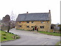
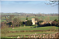
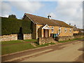
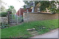
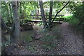
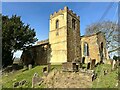
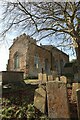
Photos of Barford St Michael


Area Information
Barford St Michael is a small, built-up area in England covering 26 hectares, offering a quiet, established living environment. With a median age of 70, it reflects a community of older residents, many of whom likely own their homes, as 87% of properties are owner-occupied. The area’s compact size means amenities are within practical reach, including nearby shops like Co-op Deddington and Asda Banbury, as well as three railway stations—Kings Sutton, Banbury, and Heyford—linking residents to broader regional networks. Daily life here is likely shaped by proximity to these services, with a focus on convenience over urban sprawl. The low crime risk score of 89 suggests a safe, stable environment, which may appeal to those prioritising security. While the area’s demographics indicate a mature population, its infrastructure—such as broadband rated 97/100—supports modern connectivity. For buyers seeking a low-maintenance, community-oriented lifestyle with reliable transport and minimal crime, Barford St Michael presents a distinct proposition.
- Area Type
- Built Up Area 250
- Area Size
- 26.0 hectares
- Population
- Not available
- Population Density
- Not available
Living in Barford St Michael offers access to essential retail and transport hubs within easy reach. Nearby shops include Co-op Deddington, Co-op Bloxham, and Asda Banbury, providing grocery and daily necessities. The three railway stations—Kings Sutton, Banbury, and Heyford—offer regular services to larger towns, facilitating both commuting and leisure travel. While the area lacks detailed data on parks or leisure facilities, its proximity to these amenities suggests a lifestyle focused on convenience and connectivity. The retail options cater to everyday needs, and the railway links ensure residents can easily access cultural, professional, or social opportunities beyond the immediate area. For those valuing a balance between local simplicity and regional access, Barford St Michael’s amenities provide a practical foundation for daily life.
Amenities
Schools
| Rank | A + A* % | School | Type | Entry gender | Ages |
|---|
Explore more schools in this area
Go to Schools tabDemographics
The population of Barford St Michael has a median age of 70, with the most common age range encompassing the total population. This suggests a community skewed towards older adults, which may influence local services and social dynamics. Home ownership is exceptionally high at 87%, indicating a stable, long-term resident base with fewer rental properties. The accommodation types and household compositions are not specified, but the data implies a mix of housing stock tailored to older demographics. There is no explicit information on ethnic diversity or religious composition, but the absence of such data does not detract from the area’s practical attributes. The high home ownership rate likely contributes to a sense of permanence, though it may limit opportunities for younger buyers or renters. For those considering the area, understanding the age profile is key to assessing whether the community aligns with personal or family needs.
Household Size
Accommodation Type
Tenure
Ethnic Group
Religion
Household Composition
Age
Household Deprivation
NS-SEC
Explore more demographic insights in this area
Go to Demographics tabPlanning
Planning Constraints
- Crime RiskLocked