Area Overview for Banbury, Calthorpe & Easington Ward
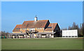
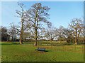
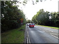
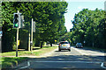
Photos of Banbury, Calthorpe & Easington Ward
Area Information
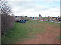
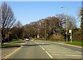
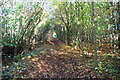
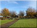
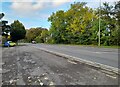
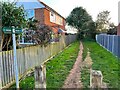
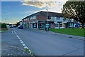
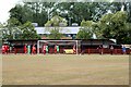
Living in Banbury, Calthorpe & Easington Ward offers proximity to the historic market town of Banbury while maintaining access to the River Cherwell. This district council ward spans 8.4 km² within Cherwell District. You reside in an area that encompasses the hamlets of Calthorpe and Easington, which historically straddled the border between Oxfordshire and Northamptonshire. Today, these areas form part of Banbury's southern and eastern suburban extents. The ward includes open farmland remnants near Strawberry Hill on the outskirts of Easington. You settle into a landscape defined by the Cherwell Valley's sloping terrain. This zone remains an integral part of the broader Banbury parliamentary constituency. The location balances established residential zones with pockets of agricultural land left from the pre-1960s era. Suburban expansion in the early 1950s linked the region to London overspill growth. If you value a connection to local history alongside modern suburban living, this ward provides a direct link to Banbury's centre. You commute through an area where ancient hamlets have integrated into the town's growth over the last century. The ward's boundaries, established by May 2016, reflect careful planning of these historic divisions.
- Area Type
- District Borough Unitary Ward
- Area Size
- 8.4 km²
- Population
- Not available
- Population Density
- Not available
Demographics
The community in Banbury, Calthorpe & Easington Ward reflects a mature population profile. The median age stands at exactly 70 years. This figure indicates a neighbourhood dominated by older residents, likely those with significant local ties. You will find that the most common age grouping spans the "Total" demographic category without specific sub-group breakdowns for individuals. Homeownership rates reach an impressive 79% within the ward. This high percentage suggests that most households own their property outright or with a substantial equity stake. You enter a market where long-term residence is the norm rather than short-term renting. The ward lacks specific data on predominant ethnic groups, household composition, religion, or religion distribution percentages. This absence of detailed breakdowns means you cannot quantify diversity for this specific ward. However, the overwhelming owner-occupier status points to a stable, established community. You settle in an area where residents have likely lived for decades. The demographic picture paints a village-like atmosphere within a parliamentary constituency. You should expect a quieter environment compared to areas with younger working-age populations. The age profile brings specific implications for local services and community engagement.
Household Size
Accommodation Type
Tenure
Ethnic Group
Religion
Household Composition
Age
Household Deprivation
NS-SEC
Explore more demographic insights in this area
Go to Demographics tabPlanning
Planning Constraints
- Flood RiskPremium
- Ramsar Wetland SitesPremium
- Area of Outstanding Natural BeautyPremium
- Protected Nature ReservePremium
- Protected WoodlandPremium
- Crime RiskPremium