Area Overview for Ashurst
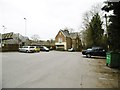
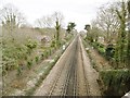
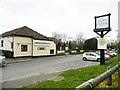
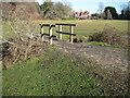
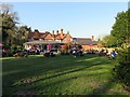
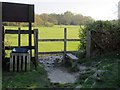
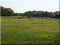
Photos of Ashurst
Area Information
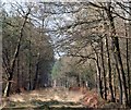
Living in Ashurst offers a compact, well-defined environment within England’s built-up areas. Covering 98.9 hectares, the area is small but functional, with a median age of 70 suggesting a community skewed toward older residents. This demographic may influence the pace of daily life, which appears to be measured and stable. The area’s proximity to Foxhills Junior and Infant Schools highlights its appeal to families, though the broader population profile remains largely unspecified. Residents benefit from a mix of retail, rail, and ferry access, ensuring practical connectivity. While the broadband score is poor, mobile coverage is good, balancing modern needs with local infrastructure. Ashurst’s character is defined by its accessibility to nearby towns like Totton and Hythe, offering a blend of rural and urban elements without overwhelming density. For buyers seeking a quieter, established community with essential services nearby, Ashurst presents a straightforward, no-frills option.
- Area Type
- Built Up Area 250
- Area Size
- 98.9 hectares
- Population
- Not available
- Population Density
- Not available
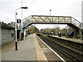
Ashurst’s residents have access to five retail outlets, including The Southern Co-operative Co, Tesco Totton, and Morrisons Daily, ensuring everyday shopping needs are met. The area’s rail links and three ferry terminals connect it to Totton, Hythe, and Southampton, expanding leisure and employment options. While only one bus route is listed, the rail and ferry networks compensate with frequent services. The compact size of Ashurst means amenities are within practical reach, though the lack of detailed data on parks or leisure facilities leaves their quality unspecified. The retail and transport infrastructure supports a self-contained lifestyle, with nearby towns offering additional choices. For those valuing convenience over extensive amenities, Ashurst’s layout is efficient.
Amenities
Schools
Ashurst is served by two primary schools: Foxhills Junior School and Foxhills Infant School, both rated “good” by Ofsted. These institutions provide a seamless transition for young children, covering early years through primary education. The presence of two schools within the area reduces the need for long commutes, benefiting families. However, no secondary schools are listed in the data, so older students may need to travel to nearby towns like Totton or Hythe. The “good” Ofsted ratings suggest reliable educational standards, though parents should verify if these schools meet their specific needs. For families prioritizing proximity to schools, Ashurst’s primary education options are a clear advantage.
| Rank | School | Type | Entry gender | Ages |
|---|
Explore more schools in this area
Go to Schools tabDemographics
Ashurst’s population has a median age of 70, indicating a predominantly older demographic. This aligns with the “Age: Total” category, which suggests limited data on specific age groups beyond this aggregate figure. Home ownership is high at 78%, reflecting a community where most residents live in their own homes rather than renting. The accommodation types and household compositions are not detailed, but the high ownership rate implies a stable, long-term resident base. There is no explicit data on ethnic diversity or religious composition, so these aspects remain unexplored. The area’s age profile may influence local services and amenities, with a focus on healthcare and retirement-focused infrastructure. For buyers, this demographic suggests a mature, low-turnover market with predictable housing needs.
Household Size
Accommodation Type
Tenure
Ethnic Group
Religion
Household Composition
Age
Household Deprivation
NS-SEC
Explore more demographic insights in this area
Go to Demographics tabPlanning
Planning Constraints
- Crime RiskPremium