Area Overview for Ashtead
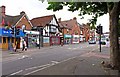
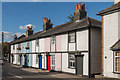
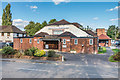
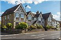
Photos of Ashtead


Area Information
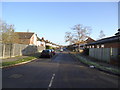
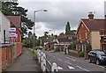
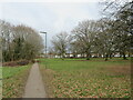
Ashtead is a small, built-up area in England, covering 5.6 km² with a population of 1607 people. Its compact size and low population density of 288 people per km² create a quiet, manageable community feel. The area is characterised by its proximity to natural features, such as Ditton Island Ferry Landing, which adds a unique dimension to local life. Daily routines in Ashtead are shaped by its strong retail presence, including Morrisons Daily and M&S Ashstead, and its reliable rail connections to Leatherhead, Epsom, and beyond. With a median age of 70, the community leans towards older residents, though the area remains accessible for families, supported by its outstanding primary schools. Living in Ashtead offers a blend of convenience and tranquillity, with easy access to amenities and a low crime risk. For those seeking a peaceful yet well-connected home, Ashtead provides a distinctive balance of rural charm and urban practicality.
- Area Type
- Built Up Area 250
- Area Size
- 5.6 km²
- Population
- 1607
- Population Density
- 288 people/km²
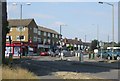
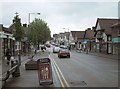
Living in Ashtead provides access to a range of amenities within practical reach. Retail options include The Southern Co-operative Co, Morrisons Daily, and M&S Ashstead, offering everyday shopping convenience. The area’s rail stations connect residents to broader networks, while the Ditton Island Ferry Landing introduces a touch of waterfront accessibility. Though specific parks or leisure facilities are not detailed in the data, the presence of multiple schools and shops suggests a well-rounded lifestyle. The compact nature of the area means residents can easily access essentials without lengthy commutes. This combination of retail, transport, and connectivity fosters a practical, community-oriented way of life, ideal for those valuing convenience without sacrificing local character.
Amenities
Schools
Ashtead is served by several high-quality primary schools, including Barnett Wood Infant School and St Peter’s Catholic Primary School, both rated outstanding by Ofsted. The Greville Primary School and West Ashtead Primary School also offer strong educational options, while St Giles’ CofE (Aided) Infant School is rated good. This concentration of primary schools makes Ashtead an attractive choice for families, with a range of religious and secular options to suit different preferences. The presence of multiple outstanding-rated schools suggests a commitment to education within the community, reducing the need for long commutes to secondary schools. For prospective buyers, the proximity to these schools is a significant advantage, particularly for those prioritising quality education for their children.
| Rank | School | Type | Entry gender | Ages |
|---|
Explore more schools in this area
Go to Schools tabDemographics
Ashtead’s population of 1607 people is relatively small, with a median age of 70, indicating a community skewed towards older residents. This age profile suggests a demographic focused on retirement or long-term residency, though the data does not specify whether this is due to migration patterns or local trends. Home ownership is high at 78%, reflecting a stable housing market with few rental properties. The accommodation types are not detailed, but the area’s built-up nature implies a mix of houses and flats. The lack of specific data on household composition or diversity means the community’s social fabric remains partially opaque, but the high home ownership rate suggests a settled, long-term population. For buyers, this profile may indicate a market with fewer short-term renters and a focus on permanent occupancy.
Household Size
Accommodation Type
Tenure
Ethnic Group
Religion
Household Composition
Age
Household Deprivation
NS-SEC
Explore more demographic insights in this area
Go to Demographics tabPlanning
Planning Constraints
- Crime RiskPremium