Area Overview for Ashford Hill
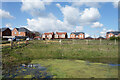
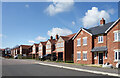
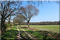
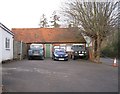
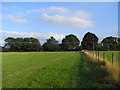
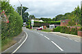
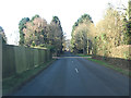
Photos of Ashford Hill


Area Information
Ashford Hill is a compact built-up area spanning 23 hectares, situated in England. Its population, while not explicitly stated, is reflected in its demographics, with a median age of 70 and a strong home ownership rate of 77%. This suggests a community of long-term residents, many of whom may have lived in the area for decades. Daily life here is shaped by its proximity to essential services, including five retail outlets such as Tesco Baughurst and The Southern Co-operative Co, and five rail stations, including Midgham and Thatcham. The area’s low crime risk, with a safety score of 80, adds to its appeal as a stable, secure place to live. For families, the presence of Ashford Hill Primary School, though listed twice in the data, indicates a focus on local education. While the area is small, its amenities and connectivity make it a practical choice for those seeking a quieter, well-serviced environment without the bustle of a larger town.
- Area Type
- Built Up Area 250
- Area Size
- 23.0 hectares
- Population
- Not available
- Population Density
- Not available
Living in Ashford Hill offers access to a range of local amenities within practical reach. The area’s five retail outlets, including Tesco Baughurst and The Southern Co-operative Co, provide essential shopping options, while nearby rail stations like Midgham and Aldermaston connect residents to broader networks. The presence of these shops and transport links supports a self-sufficient lifestyle, reducing the need for long trips to larger towns. Though no parks or leisure facilities are listed in the data, the combination of retail, rail, and proximity to schools suggests a convenient, community-oriented environment. For those who enjoy local shopping and easy access to public transport, Ashford Hill’s amenities contribute to a practical, low-maintenance daily life.
Amenities
Schools
Ashford Hill Primary School is the only school explicitly named in the data, though it is listed twice. As a primary school, it serves the local community’s younger residents, offering education for children aged 4 to 11. The lack of secondary schools or additional educational institutions means families may need to look beyond Ashford Hill for secondary education. However, the presence of a primary school is a significant draw for families, ensuring children can attend school locally without long commutes. The data does not include Ofsted ratings or academic performance metrics, so prospective parents should seek further details from the school directly. For now, the area’s focus on primary education is a clear advantage for families with young children.
| Rank | A + A* % | School | Type | Entry gender | Ages |
|---|---|---|---|---|---|
| 1 | N/A | Ashford Hill Primary School | primary | N/A | N/A |
| 2 | N/A | Ashford Hill Primary School | primary | N/A | N/A |
Explore more schools in this area
Go to Schools tabDemographics
Ashford Hill’s population has a median age of 70, with the most common age range encompassing all demographics. This suggests a community skewed towards older residents, though specific household types or diversity metrics are not detailed. Home ownership is high at 77%, indicating a majority of residents live in properties they own, which may influence the local property market and community stability. The data does not specify accommodation types or ethnic diversity, but the high home ownership rate implies a settled population with long-term ties to the area. While deprivation data is absent, the combination of strong home ownership and low crime risk suggests a generally stable quality of life. However, the lack of specific figures on household composition or diversity means broader social dynamics remain unexplored.
Household Size
Accommodation Type
Tenure
Ethnic Group
Religion
Household Composition
Age
Household Deprivation
NS-SEC
Explore more demographic insights in this area
Go to Demographics tabPlanning
Planning Constraints
- Crime RiskLocked